IMAGES TAKEN NEAR TO
Low House Close, ROCHDALE, OL16 3EP
Introduction
This page details the photographs taken nearby to Low House Close, OL16 3EP by members of the Geograph project.
The Geograph project started in 2005 with the aim of publishing, organising and preserving representative images for every square kilometre of Great Britain, Ireland and the Isle of Man.

There are currently over 7.5m images from over14,400 individuals and you can help contribute to the project by visiting https://www.geograph.org.uk
Image Map (Loading...)


Getting Data...Please wait
Leaflet Map data © OpenStreetMap
Images are licensed for reuse under creativecommons.org/licenses/by-sa/2.0
Notes
- Clicking on the map will re-center to the selected point.
- The higher the marker number, the further away the image location is from the centre of the postcode.
Image Listing (84 Images Found)
Images are licensed for reuse under creativecommons.org/licenses/by-sa/2.0
Image
Details
Distance
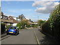
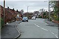
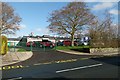
2
Lowhouse Close
Part of a 1960s housing estate.
Image: © Bryan Tenny
Taken: 5 Apr 2011
0.01 miles
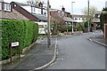
3
Kiln Lane near to the school entrance
I like the hedge, with its alternating colours.
Image: © Humphrey Bolton
Taken: 11 Apr 2019
0.03 miles
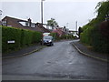
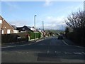
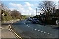
5
Cross Gates Road
Viewed from Smith Hill, this is part of a 1960s housing estate.
Image: © Bryan Tenny
Taken: 5 Apr 2011
0.04 miles
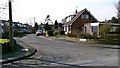
6
Cross Gates Road Milnrow
An example of middle 60's housing
Image: © Bryan Tenny
Taken: 30 Nov 2009
0.05 miles
7
Malvern Close
Part of a 1960s housing estate built on the site of Lowhouse Farm.
Image: © Bryan Tenny
Taken: 4 Mar 2011
0.05 miles
8
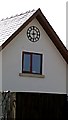
The clock on the wall
An architectural feature on a modern house built 2009-2010
Image: © Bryan Tenny
Taken: 4 Mar 2011
0.06 miles
9
Cross gates School
A modern school built in the 1970s
Image: © Bryan Tenny
Taken: 16 Feb 2011
0.07 miles
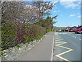
10
Kiln Lane from 'The Gallows'
A lane leading from the centre of Milnrow into the hills, taking its name from the kilns or coke ovens to which it eventually leads.
Image: © Bryan Tenny
Taken: 16 Feb 2011
0.08 miles