
IMAGES TAKEN NEAR TO
Smithy Nook, LITTLEBOROUGH, OL15 9NF
Introduction
This page details the photographs taken nearby to Smithy Nook, OL15 9NF by members of the Geograph project.
The Geograph project started in 2005 with the aim of publishing, organising and preserving representative images for every square kilometre of Great Britain, Ireland and the Isle of Man.

There are currently over 7.5m images from over14,400 individuals and you can help contribute to the project by visiting https://www.geograph.org.uk
Image Map
Images are licensed for reuse under creativecommons.org/licenses/by-sa/2.0
Notes
- Clicking on the map will re-center to the selected point.
- The higher the marker number, the further away the image location is from the centre of the postcode.
Image Listing (74 Images Found)
Images are licensed for reuse under creativecommons.org/licenses/by-sa/2.0
Image
Details
Distance
1
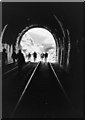
Summit Tunnel south portal
In December 1984 a train of petrol tankers derailed in Summit Tunnel between Todmorden and Littleborough, and a fire ensued reaching temperatures of over 1500 degrees Celsius, and sending columns of fire high into the air through ventilation shafts. Bricks in the tunnel vitrified. After repairs lasting 7 months, the tunnel re-opened after a charity walk through it (the picture here).
Image: © S Parish
Taken: 17 Aug 1985
0.06 miles
2
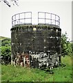
Summit Railway Tunnel Air Shaft No.2
Now the first shaft going North along the tunnel
Image: © Kevin Waterhouse
Taken: 6 Aug 2020
0.09 miles
4
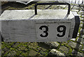
Lock no 39 Rochdale Canal
Unusually the lock number is on a plaque that has been screwed onto the lock gate arm. Normally the numbers are stencilled directly onto the wooden arm.
Image: © michael ely
Taken: 28 Jan 2010
0.11 miles
5
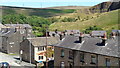
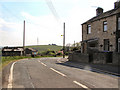
Housing at Summit
Mainly housing along the main road. The former Summit Brickworks quarry looms
Image: © Kevin Waterhouse
Taken: 17 Aug 2017
0.11 miles
6
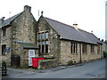
Former Stansfield Hall Infant School.
Has now been converted into Stansfield Hall Nursing Home
Image: © Alexander P Kapp
Taken: 30 May 2007
0.11 miles
7
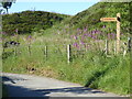
The Pennine Bridleway Mary Towneley loop near Pike Hill
Image: © Dave Kelly
Taken: 3 Jul 2019
0.11 miles
8
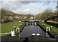
Lock no 39 Rochdale Canal
Looking north towards Summit. The canal starts to take on a more rural aspect as it approaches its highest point.
Image: © michael ely
Taken: 28 Jan 2010
0.11 miles
9
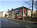
The Sportsmans Rest, Littleborough
One of the survivors along this Trans Pennine route.
Image: © al partington
Taken: 13 Dec 2007
0.12 miles
10
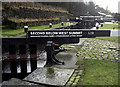
The Keith Parry Lock no 39
Looking south towards Littleborough. The lock is dedicated to a canal enthusiast.
Image: © michael ely
Taken: 28 Jan 2010
0.12 miles