IMAGES TAKEN NEAR TO
Longfellow Crescent, OLDHAM, OL1 4QW
Introduction
This page details the photographs taken nearby to Longfellow Crescent, OL1 4QW by members of the Geograph project.
The Geograph project started in 2005 with the aim of publishing, organising and preserving representative images for every square kilometre of Great Britain, Ireland and the Isle of Man.

There are currently over 7.5m images from over14,400 individuals and you can help contribute to the project by visiting https://www.geograph.org.uk
Image Map
Images are licensed for reuse under creativecommons.org/licenses/by-sa/2.0
Notes
- Clicking on the map will re-center to the selected point.
- The higher the marker number, the further away the image location is from the centre of the postcode.
Image Listing (13 Images Found)
Images are licensed for reuse under creativecommons.org/licenses/by-sa/2.0
Image
Details
Distance
1
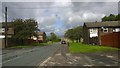
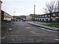
Swift Road, Sholver
A view down Swift Road in the Sholver area of Oldham, in Greater Manchester, England. In the mid-20th century, Sholver (a pleasant and ancient hillside) was converted in to one of Oldham's largest social housing estates. It's isolation and low-specification flats and town houses cemented it as one of Oldham's least desirable suburbs.
Image: © Steven Haslington
Taken: 17 Aug 2014
0.17 miles
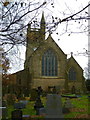
2
Sholver Lane
Sholver Lane is the road seen right of shot as it climbs from Sholver Green to its junction with the A672, Ripponden Road. Sholver parish church can be seen in the distance.
Image: © michael ely
Taken: 25 Feb 2007
0.18 miles
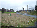
4
Top Sholver Estate
Built in 1966 ,on what had been farm pastureland, the County Borough of Oldham made a start on its huge Sholver housing estates. On elevated wind swept land, some 1,000 ft. high above sea level and open to all the elements, the local authority began its scheme to provide nearly 1,700 housing units.
Today only about half that amount remain due to redevelopment at Bottom Sholver lower down the hillside.
On the horizon behind the telegraph pole is Image
For the complete history of Sholver and surrounding area click on http://www.stthomasmoorside.org.uk/History/Local_History.htm
Image: © Paul Anderson
Taken: 26 Jan 2007
0.19 miles
5
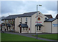
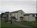
The Northgate, Sholver
This is the main estate pub situated on Sholver Green.
Image: © michael ely
Taken: 25 Feb 2007
0.21 miles
6
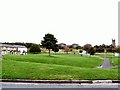
Sholver Green
The original Sholver estate was a concrete jungle of flats and maisonettes, and acquired a reputation as a no-go area. Most of the old estate was demolished and now has been rebuilt with modern housing and better, more open aspects.
Image: © Roger May
Taken: 10 Oct 2005
0.22 miles
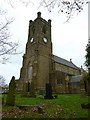
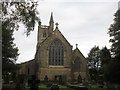
8
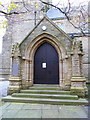
St Thomas' Church, Moorside, Porch
Image: © Alexander P Kapp
Taken: 14 Nov 2012
0.23 miles