IMAGES TAKEN NEAR TO
Marble Street, OLDHAM, OL1 4EY
Introduction
This page details the photographs taken nearby to Marble Street, OL1 4EY by members of the Geograph project.
The Geograph project started in 2005 with the aim of publishing, organising and preserving representative images for every square kilometre of Great Britain, Ireland and the Isle of Man.

There are currently over 7.5m images from over14,400 individuals and you can help contribute to the project by visiting https://www.geograph.org.uk
Image Map
Images are licensed for reuse under creativecommons.org/licenses/by-sa/2.0
Notes
- Clicking on the map will re-center to the selected point.
- The higher the marker number, the further away the image location is from the centre of the postcode.
Image Listing (44 Images Found)
Images are licensed for reuse under creativecommons.org/licenses/by-sa/2.0
Image
Details
Distance
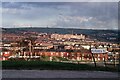
3
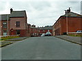
Flint Street, Oldham
Being redeveloped with thirteen houses
Image: © Alexander P Kapp
Taken: 22 Nov 2012
0.03 miles
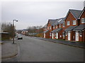
4
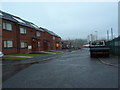
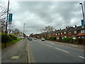
Afghan Street, Oldham
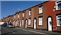
A view along Afghan Street in Oldham, Greater Manchester, England. The street is composed of red-brick terraced housing typical of much of Oldham and of Greater Manchester.
Image: © Steven Haslington
Taken: 28 Oct 2011
0.08 miles
7
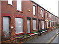
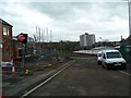
Abbotsford Road Derker Oldham
Boarded up houses await demolition
Image: © Paul Anderson
Taken: 6 Jan 2007
0.14 miles
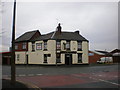
10
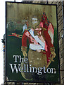
Sign for the Wellington, Oldham (north side)
Image: © JThomas
Taken: 14 Mar 2015
0.17 miles