
IMAGES TAKEN NEAR TO
Whirlaw Common, TODMORDEN, OL14 8DG
Introduction
This page details the photographs taken nearby to Whirlaw Common, OL14 8DG by members of the Geograph project.
The Geograph project started in 2005 with the aim of publishing, organising and preserving representative images for every square kilometre of Great Britain, Ireland and the Isle of Man.

There are currently over 7.5m images from over14,400 individuals and you can help contribute to the project by visiting https://www.geograph.org.uk
Image Map
Images are licensed for reuse under creativecommons.org/licenses/by-sa/2.0
Notes
- Clicking on the map will re-center to the selected point.
- The higher the marker number, the further away the image location is from the centre of the postcode.
Image Listing (9 Images Found)
Images are licensed for reuse under creativecommons.org/licenses/by-sa/2.0
Image
Details
Distance
1
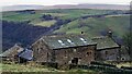
Rake Hey
View from Stoney Lane of this converted farmhouse
Image: © Kevin Waterhouse
Taken: 12 Dec 2021
0.00 miles
3
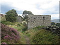
Footpath, Kit Hill
Looking WSW down the footpath towards Lower Hartley.
Image: © Mark Anderson
Taken: 23 Aug 2005
0.08 miles
5
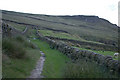
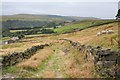
Bridleway between enclosed fields at Harley Wood Slack
The track is an ancient route from the Long Causeway towards Cross Stone. The land enclosed in the 19th century, creating a pattern of regular fields. Whirlaw Common and Whirlaw Stones can be seen in the distance
Image: © Phil Champion
Taken: 8 Jul 2007
0.14 miles
7
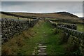
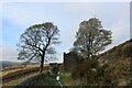
Calderdale Way approaching Whirlaw Common
Image: © Chris Heaton
Taken: 25 Oct 2022
0.18 miles
9
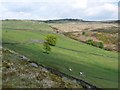
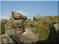
Higher Hartley, Todmorden
A farm that did not survive. The ground-floor mullioned windows can still be seen in this view from Orchan Rocks. The Bride Stones are on the skyline.
Image: © Humphrey Bolton
Taken: 13 May 2010
0.25 miles