
IMAGES TAKEN NEAR TO
Cross Stone Road, TODMORDEN, OL14 8AW
Introduction
This page details the photographs taken nearby to Cross Stone Road, OL14 8AW by members of the Geograph project.
The Geograph project started in 2005 with the aim of publishing, organising and preserving representative images for every square kilometre of Great Britain, Ireland and the Isle of Man.

There are currently over 7.5m images from over14,400 individuals and you can help contribute to the project by visiting https://www.geograph.org.uk
Image Map
Images are licensed for reuse under creativecommons.org/licenses/by-sa/2.0
Notes
- Clicking on the map will re-center to the selected point.
- The higher the marker number, the further away the image location is from the centre of the postcode.
Image Listing (120 Images Found)
Images are licensed for reuse under creativecommons.org/licenses/by-sa/2.0
Image
Details
Distance
1
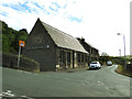
Co-Operative Funeralcare, Broadstone Street
This business, occupying a former Sunday School building, is rather out of the way, not in a town centre nor near a cemetery.
Image: © Stephen Craven
Taken: 28 Jul 2018
0.02 miles
2
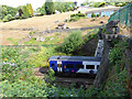
Train entering Millwood Tunnel
The tunnel is a short one, only about 200 metres.
Image: © Stephen Craven
Taken: 28 Jul 2018
0.03 miles
3
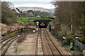
Millwood Tunnel
Millwood Tunnel at Todmorden.
Image: © Peter McDermott
Taken: 8 Apr 2018
0.03 miles
4
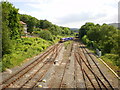
Train about to enter Millwood Tunnel
Image: © Alexander P Kapp
Taken: 5 Jun 2009
0.04 miles
5
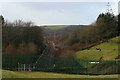
Railway as seen from Cross Stone Road
The railway comprising the Calderdale Line, emerging from the western portal of the tunnel slightly to the east of Todmorden
Image: © Chris Heaton
Taken: 6 Jan 2023
0.04 miles
6
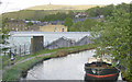
Rochdale Canal, Todmorden
Looking east along the Rochdale Canal from Baltimore Bridge, Todmorden, with Stoodley Pike on the skyline.
Image: © Martin Clark
Taken: Unknown
0.05 miles
8
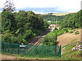
Hall Royd junction
The junction (left for Todmorden, right for Burnley) is immediately west of Millwood Tunnel.
Image: © Stephen Craven
Taken: 28 Jul 2018
0.06 miles
9
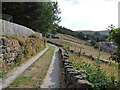
Western end of Carr House Lane
The lane has public footpath status.
Image: © Stephen Craven
Taken: 28 Jul 2018
0.06 miles
10
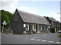
Formerly The Old School Chapel
Now used as a funeral parlour
Image: © Alexander P Kapp
Taken: 5 Jun 2009
0.07 miles