IMAGES TAKEN NEAR TO
Fir Wood Close, TODMORDEN, OL14 7QB
Introduction
This page details the photographs taken nearby to Fir Wood Close, OL14 7QB by members of the Geograph project.
The Geograph project started in 2005 with the aim of publishing, organising and preserving representative images for every square kilometre of Great Britain, Ireland and the Isle of Man.

There are currently over 7.5m images from over14,400 individuals and you can help contribute to the project by visiting https://www.geograph.org.uk
Image Map
Images are licensed for reuse under creativecommons.org/licenses/by-sa/2.0
Notes
- Clicking on the map will re-center to the selected point.
- The higher the marker number, the further away the image location is from the centre of the postcode.
Image Listing (176 Images Found)
Images are licensed for reuse under creativecommons.org/licenses/by-sa/2.0
Image
Details
Distance
2
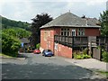
Clough Side House, Peel Cottage Road, Walsden
This was a nursing home in 1988, according to a planning application for an extension.
Image: © Humphrey Bolton
Taken: 26 Jun 2010
0.02 miles
3
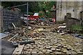
Flood damage, Clough Road near Walsden Station
Clough road was badly damaged by flash flooding in summer 2006, when a culvert beneath the road failed to cope with the volume of water. The railway line was also blocked by debris. The road and culvert have since been repaired.
Image: © Phil Champion
Taken: 25 Sep 2006
0.04 miles

5
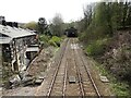
Walsden 1st railway station site, Yorkshire
Opened in 1845 by the Manchester and Leeds Railway, soon to become part of the Lancashire & Yorkshire Railway, this station closed to passengers in 1961 and was later demoolished.
View south towards Littleborough and Manchester, from a footbridge. Steps used to lead down from the footbridge to the two parallel platforms.
In 1990, a replacement station was opened immediately behind the camera position.
Image: © Nigel Thompson
Taken: 21 Apr 2021
0.04 miles
6

Footbridge, Walsden Railway Station, West Yorkshire
Image: © Robert Wade
Taken: 18 Aug 2010
0.05 miles
7
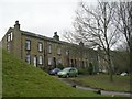
Chapel Street South - Rochdale Road
Image: © Betty Longbottom
Taken: 11 Mar 2009
0.05 miles
8
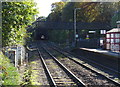
Foot bridge, Walsden Railway Station
Looking south east towards the entrance to Winterbutlee Railway Tunnel.
Image: © JThomas
Taken: 18 Oct 2018
0.06 miles
9
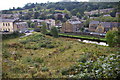
Site of former Hope Mills, Alma Road, Walsden
There was formerly a large mill on this site next to the Rochdale Canal. In 2005 planning permission was granted for the erection of 17 townhouses on the site
Image: © Phil Champion
Taken: 25 Sep 2006
0.07 miles