
IMAGES TAKEN NEAR TO
Watty Lane, TODMORDEN, OL14 7JH
Introduction
This page details the photographs taken nearby to Watty Lane, OL14 7JH by members of the Geograph project.
The Geograph project started in 2005 with the aim of publishing, organising and preserving representative images for every square kilometre of Great Britain, Ireland and the Isle of Man.

There are currently over 7.5m images from over14,400 individuals and you can help contribute to the project by visiting https://www.geograph.org.uk
Image Map
Images are licensed for reuse under creativecommons.org/licenses/by-sa/2.0
Notes
- Clicking on the map will re-center to the selected point.
- The higher the marker number, the further away the image location is from the centre of the postcode.
Image Listing (19 Images Found)
Images are licensed for reuse under creativecommons.org/licenses/by-sa/2.0
Image
Details
Distance
1
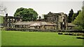
Model Farm to Dobroyd Castle
The farm from Stones Road showing its apparent Scottish style with a central tower or keep.
Image: © Kevin Waterhouse
Taken: 18 May 2020
0.02 miles
2

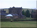
Model farm to Dobroyd Castle
These unusual farm buildings are located to the west of ImageThe two towers on the left appear to be separate dwellings. The farm is listed:
'Farm range, of eastern Keep, with flanking towers to west, the northern most forming farmhouse, all linked by low cart sheds. 2 storeys. Western towers have 2 bays of windows with plain stone surrounds to each floor. Doorway set between. Tall parapet rises to form gablet on return walls which carry dressed stacks. Eastern keep has similar parapet which is embattled with central gablet'.
Image: © Phil Champion
Taken: 19 Jun 2008
0.03 miles
4
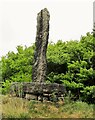
Centre Hill Monument
A possible prehistoric stone mounted on a mill stone at Stones
Image: © Kevin Waterhouse
Taken: 18 May 2020
0.06 miles
5
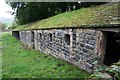
Barn, Dobroyd Model Farm
Well-made stone barn close to Image
Image: © Dave Dunford
Taken: 11 Sep 2011
0.07 miles
6
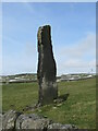
Standing Stone at Stones, Todmorden
One of three standing stones near Stones Lane, Todmorden. There is some debate as to whether all of these stones are truly ancient. There is some conjecture that one of the stones was erected to commemorate the battle of Waterloo. Two of the stones are easily seen but the largest of the stones is not near a right of way and sits at the edge of wooded land.
Image: © Catherine Chatham
Taken: 12 Mar 2023
0.07 miles
7
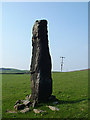
Standing Stone, Stones
At 12 feet in height this standing stone is the fourth tallest in Yorkshire. It is in a field towards the end of Stones Lane near Stones, a small community to the southwest of Todmorden.
Image: © michael ely
Taken: 8 May 2008
0.10 miles
8
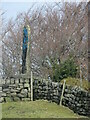
Standing stone at Stones Lane, Todmorden
One of three standing stones near Stones Lane, Todmorden. There is some debate as to whether all of these stones are truly ancient. There is some conjecture that one of the stones was erected to commemorate the battle of Waterloo. Two of the stones are easily seen but the largest of the stones, seen here, is not near a right of way and sits at the edge of wooded land. This stone appears to have been defaced with blue paint.
Image: © Catherine Chatham
Taken: 12 Mar 2023
0.12 miles
9

Footpath to the north of Stones Farm
Part of the Calderdale Way The buildings on the right are at Model Farm, originally part of the Dobroyd Castle estate.
Image: © Phil Champion
Taken: 19 Jun 2008
0.12 miles
10

Monolith at Stones
One of a number of standing stones that gave the area its name. This stone is located in a field off Stones Lane.
Image: © Phil Champion
Taken: 19 Jun 2008
0.12 miles