
IMAGES TAKEN NEAR TO
Bacup Road, TODMORDEN, OL14 7HJ
Introduction
This page details the photographs taken nearby to Bacup Road, OL14 7HJ by members of the Geograph project.
The Geograph project started in 2005 with the aim of publishing, organising and preserving representative images for every square kilometre of Great Britain, Ireland and the Isle of Man.

There are currently over 7.5m images from over14,400 individuals and you can help contribute to the project by visiting https://www.geograph.org.uk
Image Map
Images are licensed for reuse under creativecommons.org/licenses/by-sa/2.0
Notes
- Clicking on the map will re-center to the selected point.
- The higher the marker number, the further away the image location is from the centre of the postcode.
Image Listing (35 Images Found)
Images are licensed for reuse under creativecommons.org/licenses/by-sa/2.0
Image
Details
Distance

2

Field Barn in Mellings Clough
Farm building straddling the field wall
Image: © Kevin Waterhouse
Taken: 9 Jun 2021
0.03 miles
3

Sluice on Midgelden Brook
The mill race for Gorpley Mill started at this point close to Mellings Clough confluence
Image: © Kevin Waterhouse
Taken: 9 Jun 2021
0.03 miles
4

Trees toppled in Mellings Clough
These trees appear to have fallen some time ago having had their crowns removed
Image: © Kevin Waterhouse
Taken: 9 Jun 2021
0.05 miles
5

Makeshift Crossing in Mellings Clough
The stepping stones and the very low hand rail make for an exciting closing of the stream
Image: © Kevin Waterhouse
Taken: 9 Jun 2021
0.05 miles
6

Gate & Iron Pillars in Mellings Clough
Another set of pillars that are common around Stones & Dobroyd Castle. This set now appear to have little use being replaced by woodwork and wire fencing
Image: © Kevin Waterhouse
Taken: 9 Jun 2021
0.08 miles

8
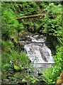
Upper Weir on Midgelden Brook
The first weir on the stream after the Gorpley Mill race sluice
Image: © Kevin Waterhouse
Taken: 9 Jun 2021
0.10 miles
9

Footpath to Gauxholme
Seen at its junction with the A681, Bacup Road, about 200 metres east of Sourhall Road.
Image: © michael ely
Taken: 14 Mar 2008
0.13 miles
10

Gorpley Clough
This is an unspoilt area of natural woodland with many waterfalls, and it is crossed by a number of wooden bridges.
Image: © Mick Melvin
Taken: 2 May 2005
0.14 miles