IMAGES TAKEN NEAR TO
Wellington Road, TODMORDEN, OL14 5EQ
Introduction
This page details the photographs taken nearby to Wellington Road, OL14 5EQ by members of the Geograph project.
The Geograph project started in 2005 with the aim of publishing, organising and preserving representative images for every square kilometre of Great Britain, Ireland and the Isle of Man.

There are currently over 7.5m images from over14,400 individuals and you can help contribute to the project by visiting https://www.geograph.org.uk
Image Map
Images are licensed for reuse under creativecommons.org/licenses/by-sa/2.0
Notes
- Clicking on the map will re-center to the selected point.
- The higher the marker number, the further away the image location is from the centre of the postcode.
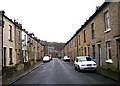
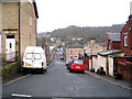
Image Listing (231 Images Found)
Images are licensed for reuse under creativecommons.org/licenses/by-sa/2.0
Image
Details
Distance
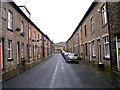
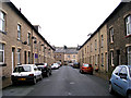
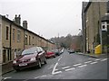
2
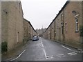
Stansfield Street - Wellington Road
Image: © Betty Longbottom
Taken: 30 Mar 2009
0.01 miles
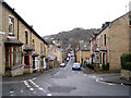
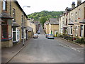

10
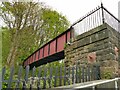
Railway footbridge at the end of Stansfield Road
I presume this is a modern steel replacement for the original bridge. See Image for a wider view including the stone setted approach ramp.
Image: © Stephen Craven
Taken: 2 May 2022
0.04 miles