
IMAGES TAKEN NEAR TO
Mortimer Street, OLDHAM, OL1 3JG
Introduction
This page details the photographs taken nearby to Mortimer Street, OL1 3JG by members of the Geograph project.
The Geograph project started in 2005 with the aim of publishing, organising and preserving representative images for every square kilometre of Great Britain, Ireland and the Isle of Man.

There are currently over 7.5m images from over14,400 individuals and you can help contribute to the project by visiting https://www.geograph.org.uk
Image Map
Images are licensed for reuse under creativecommons.org/licenses/by-sa/2.0
Notes
- Clicking on the map will re-center to the selected point.
- The higher the marker number, the further away the image location is from the centre of the postcode.
Image Listing (23 Images Found)
Images are licensed for reuse under creativecommons.org/licenses/by-sa/2.0
Image
Details
Distance
1
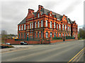
Former Oldham Board School
This grand former school building (Image]) on Shaw Rd, in Oldham was originally built in 1895 (Image]). It now houses the Groundwork Environment Centre for Oldham and Rochdale.
Image: © David Dixon
Taken: 6 Apr 2011
0.05 miles
2
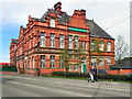
Oldham & Rochdale Groundwork Environmental Centre
The Groundwork Environment Centre for Oldham and Rochdale, is housed at this grand former school building (Image]) on Shaw Rd, in Oldham. It was originally built in 1895 (Image]).
Image: © David Dixon
Taken: 6 Apr 2011
0.05 miles
3
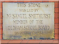
Oldham Board School - Date Stone
Dates tone on the front of Image]
Image: © David Dixon
Taken: 6 Apr 2011
0.05 miles
4
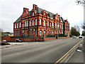
Groundwork Environmental Centre
The Groundwork Environment Centre for Oldham and Rochdale, is housed at this grand former school building (Image]) on Shaw Rd, in Oldham. It was originally built in 1895 (Image]).
Image: © David Dixon
Taken: 6 Apr 2011
0.05 miles
5

Oldham Board School - detail
Inscribed detail on the front of Image]
Image: © David Dixon
Taken: 6 Apr 2011
0.05 miles
6
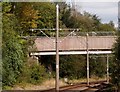
Footbridge over the tramway
Carrying a footpath from Acre to a local school.
Image: © philandju
Taken: 18 Sep 2017
0.13 miles
7
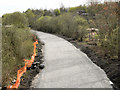
Former Oldham Loop Line
The track from the former Oldham loop (railway) line, which closed in October 2009, has been taken up and the bed is being relaid ready for the new Metrolink tramway which is due to open in 2012.
This view is looking north from the bridge at Acre Lane, Higginshaw.
Image: © David Dixon
Taken: 6 Apr 2011
0.13 miles
8
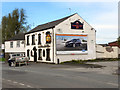
Flowerpot Inn
The Flowerpot Inn, 376 Higginshaw Lane, Royton
Image: © David Dixon
Taken: 6 Apr 2011
0.16 miles
10
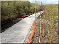
Former Oldham Loop Line
The track from the former Oldham loop (railway) line, which closed in October 2009, has been taken up and the bed is being relaid ready for the new Metrolink tramway which is due to open in 2012.
This view is looking north from the bridge at Acre Lane, Higginshaw.
Image: © David Dixon
Taken: 6 Apr 2011
0.16 miles