
IMAGES TAKEN NEAR TO
Tong Lane, BACUP, OL13 9SW
Introduction
This page details the photographs taken nearby to Tong Lane, OL13 9SW by members of the Geograph project.
The Geograph project started in 2005 with the aim of publishing, organising and preserving representative images for every square kilometre of Great Britain, Ireland and the Isle of Man.

There are currently over 7.5m images from over14,400 individuals and you can help contribute to the project by visiting https://www.geograph.org.uk
Image Map
Images are licensed for reuse under creativecommons.org/licenses/by-sa/2.0
Notes
- Clicking on the map will re-center to the selected point.
- The higher the marker number, the further away the image location is from the centre of the postcode.
Image Listing (37 Images Found)
Images are licensed for reuse under creativecommons.org/licenses/by-sa/2.0
Image
Details
Distance
1
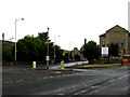
Britannia: Junction of New Line with Rochdale Road
Rochdale Road (A671) is to the right, and New Line down to the left. Although New Line is only about a mile long, it is allocated its own number, (A6066). The road is not actually new - it existed in turnpike days, before the railways came to the Bacup area.
Image: © Dr Neil Clifton
Taken: 7 Jun 2011
0.06 miles
2
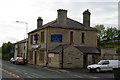
A converted pub: Sedgwick Wealth Management
This used to be the Travellers Rest.
Image: © Bill Boaden
Taken: 15 Jun 2011
0.06 miles
3
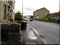
Britannia: Rochdale Road
Looking east along the A671.
Image: © Dr Neil Clifton
Taken: 8 Jun 2011
0.07 miles
4
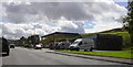
Fern Lee, Garage, Britannia.
Due to be redeveloped as flats.
Image: © Robert Wade
Taken: 5 Aug 2007
0.07 miles
5
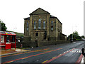
Britannia: Former Beulah Chapel
Now converted into apartments.
Image: © Dr Neil Clifton
Taken: 7 Jun 2011
0.07 miles
6
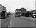
Rochdale Road, Britannia, near Bacup, Lancashire
This is part of the A671. The bus is on Route 466, Bacup to Rochdale.
Image: © Dr Neil Clifton
Taken: 20 Jul 1983
0.09 miles
7
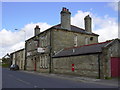
"The Travellers Rest" (Pub) Rochdale Road, Britannia
Now Sedgwick Wealth Management
Image: © Robert Wade
Taken: 5 Aug 2007
0.09 miles
8
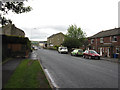
Britannia: Rochdale Road
Looking eastwards along the A671, the rear of the former Beulah Chapel (now converted into apartments) is seen on the right. Some of the apartments are still advertised for sale. The altitude here is around 1000 feet, so it can be somewhat bleak in winter!
Image: © Dr Neil Clifton
Taken: 8 Jun 2011
0.09 miles
9
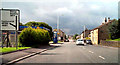
A671 Rochdale Road
As it approaches Britannia, the A671 becomes Rochdale Road.
Image: © David Dixon
Taken: 27 Aug 2010
0.10 miles
10
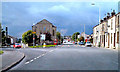
Rochdale Road, Britannia Heights
The road off to the left is the A6066. The former church at the junction has been converted into apartments.
Image: © David Dixon
Taken: 27 Aug 2010
0.11 miles