IMAGES TAKEN NEAR TO
Edward Street, BACUP, OL13 9EW
Introduction
This page details the photographs taken nearby to Edward Street, OL13 9EW by members of the Geograph project.
The Geograph project started in 2005 with the aim of publishing, organising and preserving representative images for every square kilometre of Great Britain, Ireland and the Isle of Man.

There are currently over 7.5m images from over14,400 individuals and you can help contribute to the project by visiting https://www.geograph.org.uk
Image Map
Images are licensed for reuse under creativecommons.org/licenses/by-sa/2.0
Notes
- Clicking on the map will re-center to the selected point.
- The higher the marker number, the further away the image location is from the centre of the postcode.
Image Listing (87 Images Found)
Images are licensed for reuse under creativecommons.org/licenses/by-sa/2.0
Image
Details
Distance
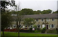
1
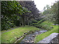
Greave Clough
This stream joins the River Irwell in a culvert under Bacup Town Centre.
Image: © Robert Wade
Taken: 22 Sep 2008
0.02 miles
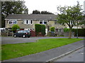
5
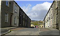
Hannah Street
Looking towards Zion Street.
Image: © Robert Wade
Taken: 24 Oct 2008
0.05 miles
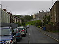
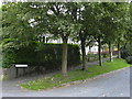
9
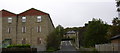
Grove Street
Grove Mill is on the left of this photo.
Image: © Robert Wade
Taken: 22 Sep 2008
0.06 miles
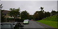
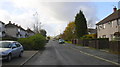
10
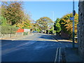
Todmorden Road (A681), Bacup
Looking north east.
Image: © JThomas
Taken: 18 Oct 2018
0.08 miles