IMAGES TAKEN NEAR TO
Melrose Terrace, BACUP, OL13 8QD
Introduction
This page details the photographs taken nearby to Melrose Terrace, OL13 8QD by members of the Geograph project.
The Geograph project started in 2005 with the aim of publishing, organising and preserving representative images for every square kilometre of Great Britain, Ireland and the Isle of Man.

There are currently over 7.5m images from over14,400 individuals and you can help contribute to the project by visiting https://www.geograph.org.uk
Image Map
Images are licensed for reuse under creativecommons.org/licenses/by-sa/2.0
Notes
- Clicking on the map will re-center to the selected point.
- The higher the marker number, the further away the image location is from the centre of the postcode.
Image Listing (27 Images Found)
Images are licensed for reuse under creativecommons.org/licenses/by-sa/2.0
Image
Details
Distance
1
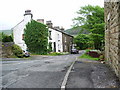
Weir Lane
Looking down Weir Lane from Burnley Road
Image: © Alexander P Kapp
Taken: 30 May 2008
0.01 miles
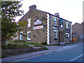
5
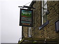
Pub Sign
Named after a feature on the nearby River Irwell.
Image: © Robert Wade
Taken: 27 Jan 2008
0.06 miles
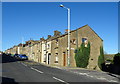
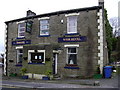
6
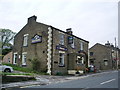
Weir Hotel, Burnley Road, Weir, Bacup
Image: © Alexander P Kapp
Taken: 30 May 2008
0.06 miles
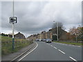
8
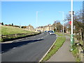
Burnley Road, Weir
Looking north on the A671.
Image: © JThomas
Taken: 18 Oct 2018
0.07 miles
9
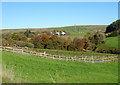
Grazing, Weir
Off Burnley Road.
The track goes to Scar End Farm.
Image: © JThomas
Taken: 18 Oct 2018
0.08 miles
10
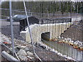
River Irwell
Note the discolouration of the gravel and the new parapets
Image: © Robert Wade
Taken: 27 Jan 2008
0.09 miles