
IMAGES TAKEN NEAR TO
Tunstead, BACUP, OL13 8NF
Introduction
This page details the photographs taken nearby to Tunstead, OL13 8NF by members of the Geograph project.
The Geograph project started in 2005 with the aim of publishing, organising and preserving representative images for every square kilometre of Great Britain, Ireland and the Isle of Man.

There are currently over 7.5m images from over14,400 individuals and you can help contribute to the project by visiting https://www.geograph.org.uk
Image Map
Images are licensed for reuse under creativecommons.org/licenses/by-sa/2.0
Notes
- Clicking on the map will re-center to the selected point.
- The higher the marker number, the further away the image location is from the centre of the postcode.
Image Listing (6 Images Found)
Images are licensed for reuse under creativecommons.org/licenses/by-sa/2.0
Image
Details
Distance
2
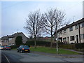
Housing Estate, Stacksteads
These houses on Tunstead Crescent are at the very edge of the Rossendale Valley's built-up-area. Behind the houses is farmland, and beyond that is open moorland.
Image: © michael ely
Taken: 30 Jan 2006
0.13 miles
3
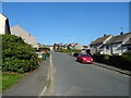
Tunstead Road, Stacksteads, Bacup
Looking north east.
Image: © JThomas
Taken: 10 Oct 2018
0.16 miles
4
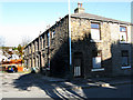
Bacup: Stansfield Street, Stacksteads
One of several blocks along Booth Road which were originally built as back-to-backs.
Image: © Dr Neil Clifton
Taken: 10 Nov 2010
0.22 miles
5
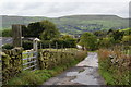
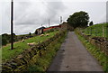
Lane descending to Mitchell Fold
Cowpe Lowe is the hill straight ahead.
Image: © Bill Boaden
Taken: 2 Oct 2010
0.22 miles
6
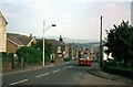
Bus on Booth Lane, Stacksteads - 1981
This was part of the 'back road' service along the Rossendale Valley. The bus is Rossendale Transport 54, a Leyland Leopard with East Lancs bodywork, new in 1968.
This is one of a series of views featuring buses in the 60s, 70s, and 80s. http://www.geograph.org.uk/search.php?i=137652761
Image: © Alan Murray-Rust
Taken: 1 Sep 1981
0.23 miles