
IMAGES TAKEN NEAR TO
Heatherlands, ROCHDALE, OL12 8NW
Introduction
This page details the photographs taken nearby to Heatherlands, OL12 8NW by members of the Geograph project.
The Geograph project started in 2005 with the aim of publishing, organising and preserving representative images for every square kilometre of Great Britain, Ireland and the Isle of Man.

There are currently over 7.5m images from over14,400 individuals and you can help contribute to the project by visiting https://www.geograph.org.uk
Image Map
Images are licensed for reuse under creativecommons.org/licenses/by-sa/2.0
Notes
- Clicking on the map will re-center to the selected point.
- The higher the marker number, the further away the image location is from the centre of the postcode.
Image Listing (16 Images Found)
Images are licensed for reuse under creativecommons.org/licenses/by-sa/2.0
Image
Details
Distance
1
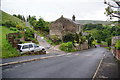
Track and path off Oak Street
The track is just an entrance to Cowm Farm. The path goes up the hill to the left from the track junction. It was my intended route but I found that it was closed due to a dangerous section of quarry. The quarry has possibly swallowed it up as it has already done to other paths.
Image: © Bill Boaden
Taken: 15 Jun 2011
0.12 miles

4
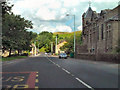
Market Street (A671), Shawforth
The building on the right, which looks like it might once have been a church, now houses an IT management company
Image: © David Dixon
Taken: 27 Aug 2010
0.14 miles
5
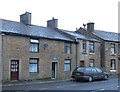
It's in the back yard Your Majesty.
On 9th July 1913, King George V and Queen Mary visited this house at 43 Market Street, Shawforth, while passing through Whitworth en route to Rochdale on a Royal Tour of Lancashire. And there's a blue plaque to prove it.
Image: © michael ely
Taken: 20 Jan 2006
0.15 miles
6
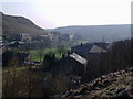
Whitworth Valley over Oak St
South down the Whitworth Valley overlooking Oak St
Image: © Peter Holton
Taken: 31 Mar 2004
0.15 miles
7
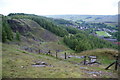
Path down from Cowm Top
This goes past Facit Quarries on the way towards Shawforth.
Image: © Bill Boaden
Taken: 15 Jun 2011
0.16 miles


10
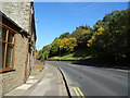
Market Street (A671) towards Shawforth
Looking north east.
Image: © JThomas
Taken: 10 Oct 2018
0.21 miles