IMAGES TAKEN NEAR TO
Edenfield Road, ROCHDALE, OL12 7TT
Introduction
This page details the photographs taken nearby to Edenfield Road, OL12 7TT by members of the Geograph project.
The Geograph project started in 2005 with the aim of publishing, organising and preserving representative images for every square kilometre of Great Britain, Ireland and the Isle of Man.

There are currently over 7.5m images from over14,400 individuals and you can help contribute to the project by visiting https://www.geograph.org.uk
Image Map
Images are licensed for reuse under creativecommons.org/licenses/by-sa/2.0
Notes
- Clicking on the map will re-center to the selected point.
- The higher the marker number, the further away the image location is from the centre of the postcode.
Image Listing (9 Images Found)
Images are licensed for reuse under creativecommons.org/licenses/by-sa/2.0
Image
Details
Distance
1
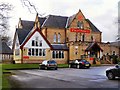
Nutters Restaurant
Originally an 18th century manor house, Nutters set in 6½ acres of groomed parkland off Edenfield Road, Norden.
http://www.nuttersrestaurant.co.uk/about_nutters_restaurant.html
Image: © David Dixon
Taken: 12 Feb 2010
0.07 miles
2

Scout Moor Wind Farm Official Opening
Having seen some of my images on this very web site http://www.geograph.org.uk/gallery/scout_moor_wind_farm_under_construction_6568
the developers Peel Holdings contacted myself for permission to use the above images plus quite a number of others on separate stands at the official opening which took place at Nutters Restaurant in Norden near Rochdale followed by a ribbon cutting ceremony up on the moor on the 25th of September 2008.
The above display was also used at the Wind Energy event in London during October 2008.
Top row from left to right are
Image
Image
Image
Bottom row from left to right
Image
Image
Image
Following a public inquiry held in 2004, planning consent was granted by the Secretary of State on the 25th May 2005 for the building of Scout Moor Wind Farm.
Construction of the wind turbines began back in November 2007 at Turbine No 16.
By June 2008 engineers had constructed 26 wind turbine towers and installed 78 turbine blades 450 metres above sea level on Scout Moor amid adverse weather conditions of thick fog, gale force winds, torrential rain, snow and ice during the winter months of 2008.
On the 25th of September 2008 dignitaries from across the North West were invited to the official opening of the Scout Moor wind farm.
Children from Edenfield Primary School, who have enjoyed lessons based around the wind farm, were on hand to cut the ribbon at Turbine No 22.http://www.geograph.org.uk/photo/980311
Head Teacher at Edenfield Primary School, Janet Reidy, said: "It was superb for the children to be involved after all the work they had done about the wind farm in their lessons.
I think they will all remember this in future years and now they know what it's like to be film stars with all the camera crews there!"
Richard Dibley, wind power development manager at Peel, said at the opening: "We have welcomed people here today to thank them for their patience and understanding during the construction period and for them to see the wind farm in action at close quarters. I think we have chosen the perfect site here as it is more than 50% windier up here than it is in the surrounding area. These turbines will be generating power for years to come using a natural resource that will never run out."
Image: © Paul Anderson
Taken: 25 Sep 2008
0.09 miles
3
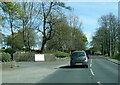
A680 passing entrance to Nutters restaurant
Image: © Colin Pyle
Taken: 23 Apr 2021
0.09 miles
4
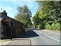
Edenfield Road, Wolstenholme
Looking north west on the A680.
Image: © JThomas
Taken: 25 Sep 2018
0.12 miles
5
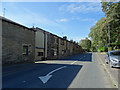
Terraced housing on Edenfield Road, Wolstenholme
Image: © JThomas
Taken: 25 Sep 2018
0.16 miles
7
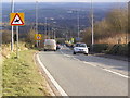
Edenfield Road
The busy A680, dropping downhill towards Norden.
Image: © David Dixon
Taken: 12 Feb 2010
0.21 miles