
IMAGES TAKEN NEAR TO
Foot Mill Crescent, ROCHDALE, OL12 6PF
Introduction
This page details the photographs taken nearby to Foot Mill Crescent, OL12 6PF by members of the Geograph project.
The Geograph project started in 2005 with the aim of publishing, organising and preserving representative images for every square kilometre of Great Britain, Ireland and the Isle of Man.

There are currently over 7.5m images from over14,400 individuals and you can help contribute to the project by visiting https://www.geograph.org.uk
Image Map
Images are licensed for reuse under creativecommons.org/licenses/by-sa/2.0
Notes
- Clicking on the map will re-center to the selected point.
- The higher the marker number, the further away the image location is from the centre of the postcode.
Image Listing (12 Images Found)
Images are licensed for reuse under creativecommons.org/licenses/by-sa/2.0
Image
Details
Distance
1
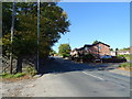
Shawclough Road (B6377)
Looking north west.
Image: © JThomas
Taken: 10 Oct 2018
0.12 miles
2
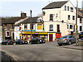
Shawclough Post Office
Shawclough Road, Rochdale.
Image: © David Dixon
Taken: 3 Mar 2010
0.12 miles
3
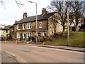
The Talbot Head, Shawclough
Shawclough Road, Rochdale
Image: © David Dixon
Taken: 3 Mar 2010
0.12 miles
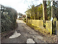
6
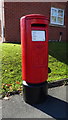
Elizabeth II postbox on Shawclough Road, Rochdale
Postbox No. OL12 80.
Image: © JThomas
Taken: 10 Oct 2018
0.20 miles
7
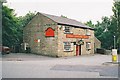
Royds Arms, Rooley Moor Road, Rochdale, Lancashire
A very old pub still serving good ale
Image: © Dr Neil Clifton
Taken: 19 Jul 2002
0.21 miles
8
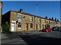
Terraced housing on Shawclough Road (B6377)
Image: © JThomas
Taken: 10 Oct 2018
0.23 miles
9
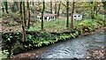
Former Allotments
By the River Spodden, off Spod Road.
Image: © Kevin Waterhouse
Taken: 24 Oct 2022
0.24 miles
10
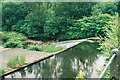
Weir on River Spodden, Rochdale
The River Spodden, locally known as the 'Spod', is not one of England's better-known waterways. It rises on the moors above Shawforth with many minor sources, and flows through the Whitworth valley, finally debouching into the Roch at 891133.
Image: © Dr Neil Clifton
Taken: 19 Jul 2002
0.24 miles