1
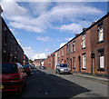
Newchurch Street, Castleton
A view up Newchurch Street, in the Castleton area of Rochdale, Greater Manchester, England. These red-brick terraced houses are typical of much of Castleton, of Rochdale, and of Greater Manchester in general.
Image: © Steven Haslington
Taken: 6 Jul 2011
0.04 miles
2
Newchurch Street, Castleton
A fine display of terraced houses, but they weren't built to accommodate a car for each house.
Image: © Bill Boaden
Taken: 2 Sep 2010
0.05 miles
3
St Martin's Church, Castleton Moor
Viewed from Vicarage Road North.
Image: © David Dixon
Taken: 20 Apr 2010
0.09 miles
4
St Martin's Church and Graveyard, Castleton Moor
Image: © David Dixon
Taken: 20 Apr 2010
0.09 miles
5
St Martin's Church, Castleton Moor
Viewed from Manchester Road.
Image: © David Dixon
Taken: 20 Apr 2010
0.09 miles
6
Old Lock, Rochdale Canal
This former lock on the Rochdale Canal near Castleton, Rochdale, is no longer used as a lock and the canal passes straight through. The level of the canal south of the lock was raised to connect to a diverted route passing though a tunnel below the M62 motorway. A new lock was constructed on the other side of the motorway, see
Image
Image: © Martin Clark
Taken: Unknown
0.09 miles
7
St Martin's Church, Castleton Moor
Image: © Alexander P Kapp
Taken: 17 Oct 2005
0.09 miles
8
Former Castleton Branch Library, Rochdale Road
The main entrance. See https://www.geograph.org.uk/photo/7145824 for more information. The lower line of inscription behind the lamp reads 'Restored in memory of Maureen Crewe 1945 – 2015'. There is another modern inscription to the left of the door https://www.geograph.org.uk/photo/7145828 .
Image: © Alan Murray-Rust
Taken: 8 Apr 2022
0.10 miles
9
Former Castleton Branch Library, Rochdale Road
Re-purposed as business premises and re-opened in 2019. It also contains a meeting room - formerly the reading room - run by the Friends of Carnegie (Castleton) who campaigned for the refurbishment of the building following its closure as a library in 2007.
The library was built in 1905, architect Jesse Horsfall, with a donation of £2,500 from Andrew Carnegie. The restoration was carried out through the co-operation of Nick Crewe of Crewe Industrial Services, local property owners and engineers.
Image: © Alan Murray-Rust
Taken: 8 Apr 2022
0.10 miles
10
Former Castleton Branch Library, Rochdale Road
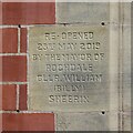
Inscription commemorating the re-opening of the building in 2019 – see https://www.geograph.org.uk/photo/7145824 for more details.
Image: © Alan Murray-Rust
Taken: 8 Apr 2022
0.10 miles


