
IMAGES TAKEN NEAR TO
Hillcrest Road, ROCHDALE, OL11 2QB
Introduction
This page details the photographs taken nearby to Hillcrest Road, OL11 2QB by members of the Geograph project.
The Geograph project started in 2005 with the aim of publishing, organising and preserving representative images for every square kilometre of Great Britain, Ireland and the Isle of Man.

There are currently over 7.5m images from over14,400 individuals and you can help contribute to the project by visiting https://www.geograph.org.uk
Image Map
Images are licensed for reuse under creativecommons.org/licenses/by-sa/2.0
Notes
- Clicking on the map will re-center to the selected point.
- The higher the marker number, the further away the image location is from the centre of the postcode.
Image Listing (26 Images Found)
Images are licensed for reuse under creativecommons.org/licenses/by-sa/2.0
Image
Details
Distance
1
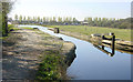
Old Lock, Rochdale Canal
This former lock on the Rochdale Canal near Castleton, Rochdale, is no longer used as a lock and the canal passes straight through. The level of the canal south of the lock was raised to connect to a diverted route passing though a tunnel below the M62 motorway. A new lock was constructed on the other side of the motorway, see Image
Image: © Martin Clark
Taken: Unknown
0.16 miles
2
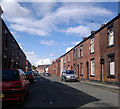
Newchurch Street, Castleton
A view up Newchurch Street, in the Castleton area of Rochdale, Greater Manchester, England. These red-brick terraced houses are typical of much of Castleton, of Rochdale, and of Greater Manchester in general.
Image: © Steven Haslington
Taken: 6 Jul 2011
0.16 miles
3
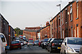
Newchurch Street, Castleton
A fine display of terraced houses, but they weren't built to accommodate a car for each house.
Image: © Bill Boaden
Taken: 2 Sep 2010
0.16 miles
4
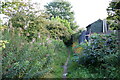
Path on the edge of the estate
To the right is the back of Leander Drive. To the left are open fields.
Image: © Bill Boaden
Taken: 2 Sep 2010
0.18 miles
5
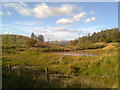
Scout Moor from Castleton
From this deceptively rural looking part of Castleton, in Rochdale, appears the tower and chimney of Arrow Mill, and beyond that, Scout Moor Wind Farm.
Image: © Steven Haslington
Taken: 16 Oct 2009
0.20 miles
6
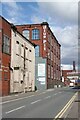
Blue Pit Mill, Queensway, Rochdale
Former cotton spinning mill, now converted to office space. Blue Pits (sic) was one of the earliest mills in the area, dating from the mid/late 19th century, but this building is a later development, probably from the first decade of the 20th century.
Image: © Alan Murray-Rust
Taken: 8 Apr 2022
0.21 miles
7
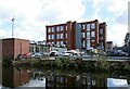
Blue Pit Mill, Castleton
The name comes from Bluepits/Blue Pits, an old name for this part of Castleton, resulting from the blue clay that was quarried in the area. As Blue Pits Mill, it was one of the earliest mills in the area, but older buildings have all been demolished leaving just this early 20th century building, now converted to small business units.
Image: © Alan Murray-Rust
Taken: 8 Apr 2022
0.22 miles
8
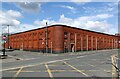
Linden Mills, Castleton
OS mapping shows that this was the first mill to be built in Castleton, dating from the 1840s or earlier. This building was the weaving shed and the style indicates that it dates from probably the early years of the 20th century. It is the last remaining element of the cotton manufacturing life of the mill which now houses a firm which manufactures paper and board products for industrial packaging. It has grade 2 local interest listed status.
Image: © Alan Murray-Rust
Taken: 8 Apr 2022
0.22 miles
9
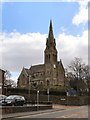
St Martin's Church, Castleton Moor
Viewed from Manchester Road.
Image: © David Dixon
Taken: 20 Apr 2010
0.23 miles
10
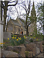
St Martin's Church, Castleton Moor
Viewed from Vicarage Road North.
Image: © David Dixon
Taken: 20 Apr 2010
0.23 miles