
IMAGES TAKEN NEAR TO
Exeter Grove, ROCHDALE, OL11 1JW
Introduction
This page details the photographs taken nearby to Exeter Grove, OL11 1JW by members of the Geograph project.
The Geograph project started in 2005 with the aim of publishing, organising and preserving representative images for every square kilometre of Great Britain, Ireland and the Isle of Man.

There are currently over 7.5m images from over14,400 individuals and you can help contribute to the project by visiting https://www.geograph.org.uk
Image Map
Images are licensed for reuse under creativecommons.org/licenses/by-sa/2.0
Notes
- Clicking on the map will re-center to the selected point.
- The higher the marker number, the further away the image location is from the centre of the postcode.
Image Listing (245 Images Found)
Images are licensed for reuse under creativecommons.org/licenses/by-sa/2.0
Image
Details
Distance
1
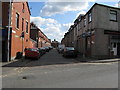
Rochdale: Maldon Street
Seen from its junction with Milkstone Road. Most Victorian terrace houses still survive on this street.
Image: © Dr Neil Clifton
Taken: 18 Mar 2011
0.01 miles
2
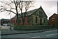
Baptist Church, Overt Street, Deeplish, Rochdale Lancashire.
Unlike many smaller nonconformist churches, which have 'gone under', this one is still holding its own in an area mainly occupied by people of New Commonwealth origin.
Image: © Dr Neil Clifton
Taken: 22 Mar 2004
0.03 miles
3
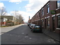
Rochdale: Durham Street
Seen from its junction with Miall Street,from where this long street runs right through to a junction with Oldham Road. A minaret of the new mosque built recently can just be seen.
Image: © Dr Neil Clifton
Taken: 18 Mar 2011
0.04 miles
4
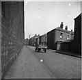
Rag and Bone Man, Miall Street, Rochdale, Lancashire
Rag and bone men are no longer seen in Rochdale but in the 1950's they were common. Most had just handcarts with wheels recovered from old mangles - only the more 'aristocratic' men had any kind of horse or donkey. Here a typical rag and bone man is seen in Miall Street, a long and dismal street that ran (and still does) behind the railway station.
Image: © Dr Neil Clifton
Taken: 6 Apr 1955
0.04 miles
5
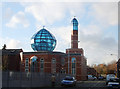
Mosque, Durham Street, Rochdale
A striking piece of Islamic architecture near Rochdale's railway station. Situated on the corner of Durham Street and Hare Street.
Image: © michael ely
Taken: 28 Nov 2006
0.05 miles
7
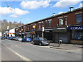
Rochdale: Shops on Milkstone Road
This parade of local shops is beginning to suffer from closures as out-of-town shopping with the car takes away more and more trade. At the far left hand en is seen what once was the 'Brown Cow' public house - now itself closed and converted into a 'minimart'.
Image: © Dr Neil Clifton
Taken: 18 Mar 2011
0.05 miles
8

Colby Street (East side), Rochdale, Lancashire
During 1979, the demolition of a large area of terrace houses south east of Rochdale station was being progressed. This is - or was - Colby Street, with its T-junction with Hare Street just beyond the block under demolition, and Equitable Street further on.
Image: © Dr Neil Clifton
Taken: 24 Sep 2007
0.05 miles
9
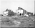
Colby Street, Rochdale, Lancashire
Almost certainly the last photograph anyone took of this street!
Image: © Dr Neil Clifton
Taken: 15 Sep 1979
0.05 miles
10
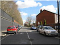
Rochdale: Miall Street
See also Image, taken by me in the same place some 55 years earlier.
Image: © Dr Neil Clifton
Taken: 18 Mar 2011
0.06 miles