IMAGES TAKEN NEAR TO
Newbury Grove, HEYWOOD, OL10 2PL
Introduction
This page details the photographs taken nearby to Newbury Grove, OL10 2PL by members of the Geograph project.
The Geograph project started in 2005 with the aim of publishing, organising and preserving representative images for every square kilometre of Great Britain, Ireland and the Isle of Man.

There are currently over 7.5m images from over14,400 individuals and you can help contribute to the project by visiting https://www.geograph.org.uk
Image Map (Loading...)


Getting Data...Please wait
Leaflet Map data © OpenStreetMap
Images are licensed for reuse under creativecommons.org/licenses/by-sa/2.0
Notes
- Clicking on the map will re-center to the selected point.
- The higher the marker number, the further away the image location is from the centre of the postcode.
Image Listing (10 Images Found)
Images are licensed for reuse under creativecommons.org/licenses/by-sa/2.0
Image
Details
Distance
2
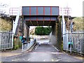
Pot Hall Bridge
The railway bridge looking towards Wilton Grove
Image: © David Dixon
Taken: 1 Feb 2010
0.21 miles
3
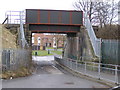
Pot Hall Bridge
Looking from Wilton Grove.
Image: © David Dixon
Taken: 1 Feb 2010
0.22 miles
4
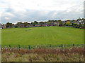
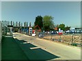
Recreation ground south of the East Lancashire Railway
Image: © SMJ
Taken: 20 Oct 2012
0.22 miles
6
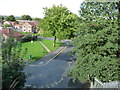
Footpath from Chestnut Gardens, Heywood
Worn by countless people heading for the railway underbridge.
Image: © Christine Johnstone
Taken: 6 Sep 2018
0.23 miles
7
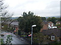
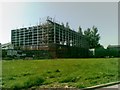
Greenfield Court, Heywood
Houses seen from the East Lancashire Railway
Image: © Chris Allen
Taken: 20 Oct 2019
0.24 miles
8
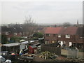
The rear of houses on Wolsey Street
Image: © Jonathan Thacker
Taken: 23 Jan 2016
0.24 miles
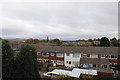
9
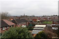
Backs of the houses on Wilton Grove, Heywood
Seen from the East Lancashire Railway between Heywood and Bury.
Image: © Chris Allen
Taken: 11 Mar 2017
0.24 miles