
IMAGES TAKEN NEAR TO
Middleton Road, HEYWOOD, OL10 2HY
Introduction
This page details the photographs taken nearby to Middleton Road, OL10 2HY by members of the Geograph project.
The Geograph project started in 2005 with the aim of publishing, organising and preserving representative images for every square kilometre of Great Britain, Ireland and the Isle of Man.

There are currently over 7.5m images from over14,400 individuals and you can help contribute to the project by visiting https://www.geograph.org.uk
Image Map
Images are licensed for reuse under creativecommons.org/licenses/by-sa/2.0
Notes
- Clicking on the map will re-center to the selected point.
- The higher the marker number, the further away the image location is from the centre of the postcode.
Image Listing (32 Images Found)
Images are licensed for reuse under creativecommons.org/licenses/by-sa/2.0
Image
Details
Distance
1
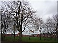
Trees in the school grounds
On the north side of Coronation Avenue.
Image: © Christine Johnstone
Taken: 12 Nov 2010
0.07 miles
2

Back Lane in Heywood
This is the rear access for the terraced houses on
Marlborough Street and Byng Street in Heywood.
Notice the wheelie bins are stored in an orderly fashion all down one side of the lane so the refuse vehicle can get through unhindered
Image: © Paul Anderson
Taken: 6 Oct 2008
0.08 miles
3
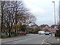
Junction of Coronation Avenue and Middleton Road
Seen from Arnold Avenue.
Image: © Christine Johnstone
Taken: 12 Nov 2010
0.10 miles

5

Service station on Middleton Road (A6046), Heywood
Image: © JThomas
Taken: 25 Sep 2018
0.11 miles

7
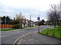
Arnold Avenue, Hopwood
Taken from Coronation Avenue.
Image: © Christine Johnstone
Taken: 12 Nov 2010
0.11 miles
8
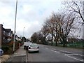
Coronation Avenue, Hopwood
Judging from the houses, George the Sixth's coronation.
Image: © Christine Johnstone
Taken: 12 Nov 2010
0.11 miles
9
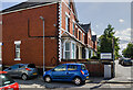
WWII Lancashire: Ghost Signs of the Home Front (15)
-
Emergency Rendezvous Point, Baker Street, at junction with Manchester Road, Heywood, Bury
"ERP 235"
Emergency Rendezvous Points (ERP) were designated places in the locality for the coordination of ARP and emergency services during civil emergencies, particularly for those services arriving from outside the area. The signs appear in a variety of designs, but most are diamond shapes framing the ERP locality number.
Image
Image: © Mike Searle
Taken: 13 Aug 2021
0.11 miles
10
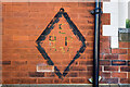
WWII Lancashire: Ghost Signs of the Home Front (14)
-
Emergency Rendezvous Point, Baker Street, at junction with Manchester Road, Heywood, Bury
"ERP 235"
Emergency Rendezvous Points (ERP) were designated places in the locality for the coordination of ARP and emergency services during civil emergencies, particularly for those services arriving from outside the area. The signs appear in a variety of designs, but most are diamond shapes framing the ERP locality number.
Image
Image: © Mike Searle
Taken: 13 Aug 2021
0.12 miles