IMAGES TAKEN NEAR TO
Clarkes Close, NORWICH, NR9 4BB
Introduction
This page details the photographs taken nearby to Clarkes Close, NR9 4BB by members of the Geograph project.
The Geograph project started in 2005 with the aim of publishing, organising and preserving representative images for every square kilometre of Great Britain, Ireland and the Isle of Man.

There are currently over 7.5m images from over14,400 individuals and you can help contribute to the project by visiting https://www.geograph.org.uk
Image Map
Images are licensed for reuse under creativecommons.org/licenses/by-sa/2.0
Notes
- Clicking on the map will re-center to the selected point.
- The higher the marker number, the further away the image location is from the centre of the postcode.
Image Listing (13 Images Found)
Images are licensed for reuse under creativecommons.org/licenses/by-sa/2.0
Image
Details
Distance
6
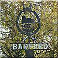
Barford village sign
Barley Ford is the presumed derivation of Barford. The sign which takes the form of a horseshoe. complete with the correct number of nailholes, is surmounted by a Viking horned helmet, below which is the church in accurate detail, with the date 1308, which was when the nave was built. The tower and chancel were added about a century later. Below the church the Viking past is again depicted with a Viking longship in full sail and the date AD 700 on the bottom of the horseshoe.
https://www.geograph.org.uk/photo/6693889
Image: © Adrian S Pye
Taken: 1 Dec 2020
0.18 miles
7
Barford village sign
Barley Ford is the presumed derivation of Barford. The sign which takes the form of a horseshoe. complete with the correct number of nailholes, is surmounted by a Viking horned helmet, below which is the church in accurate detail, with the date 1308, which was when the nave was built. The tower and chancel were added about a century later. Below the church the Viking past is again depicted with a Viking longship in full sail and the date AD 700 on the bottom of the horseshoe.
https://www.geograph.org.uk/photo/6693888
Image: © Adrian S Pye
Taken: 1 Dec 2020
0.18 miles
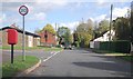
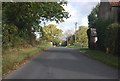
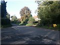
8

Junction of Church Lane and Cock St, Barford
Image: © N Chadwick
Taken: 19 Oct 2014
0.19 miles
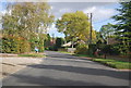
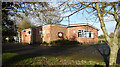
9
Crossroads, Barford
By the village hall and village sign.
Image: © Katy Walters
Taken: 12 Nov 2005
0.21 miles