
IMAGES TAKEN NEAR TO
Sabberton Drive, NR8 7AJ
Introduction
This page details the photographs taken nearby to Sabberton Drive, NR8 7AJ by members of the Geograph project.
The Geograph project started in 2005 with the aim of publishing, organising and preserving representative images for every square kilometre of Great Britain, Ireland and the Isle of Man.

There are currently over 7.5m images from over14,400 individuals and you can help contribute to the project by visiting https://www.geograph.org.uk
Image Map
Images are licensed for reuse under creativecommons.org/licenses/by-sa/2.0
Notes
- Clicking on the map will re-center to the selected point.
- The higher the marker number, the further away the image location is from the centre of the postcode.
Image Listing (27 Images Found)
Images are licensed for reuse under creativecommons.org/licenses/by-sa/2.0
Image
Details
Distance
1
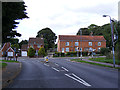
Hall Lane, Drayton
At the junction with School Road
Road no.C282
Image: © Geographer
Taken: 26 Sep 2013
0.17 miles
2
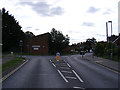
School Road, Drayton
At the junction with Hall Lane
Road no.C282
Image: © Geographer
Taken: 26 Sep 2013
0.18 miles
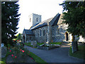
4
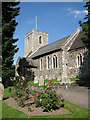
St Margaret's church in Drayton
Much of St Margaret's church > http://www.geograph.org.uk/photo/2055012 was rebuilt in the 19th century after the tower had collapsed in 1850. The church is much restored and only the C12 baptismal font and the entrance to the old rood loft stairway remain from earlier times.
Image: © Evelyn Simak
Taken: 6 Sep 2010
0.21 miles
5
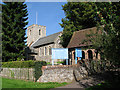
St Margaret's church in Drayton
Much of St Margaret's church was rebuilt in the 19th century after the tower had collapsed in 1850. The church is much restored and only the C12 baptismal font and the entrance to the old rood loft stairway remain from earlier times.
Image: © Evelyn Simak
Taken: 6 Sep 2010
0.21 miles
6
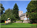
Children's playground in Drayton
It is situated immediately to the south of St Margaret's church which can be seen in the background.
Image: © Evelyn Simak
Taken: 6 Sep 2010
0.21 miles
8
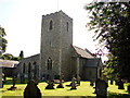
Drayton St Margaret's church
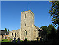
The church with its thatched nave and un-buttressed tower is almost hidden behind the trees on the village green. If it is locked the key-holder is not far away. The church is entered by a simple small south porch; immediately, the visitor is greeted by a plain font which stands on Norman shafts, but I believe the octagonal bowl to be a little later.
Image: © Adrian S Pye
Taken: 1 Jul 2009
0.22 miles
9
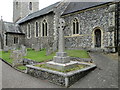
The Drayton War Memorial by Drayton church
The memorial bear just the names of the WW1 casualties. The complete list is on the Memorial in the church http://www.geograph.org.uk/photo/4571610 where one names differs in respect of the initial of the middle name.
C.W. WARNES on the cross but C.H. WARNES on the church memorial.
Image: © Adrian S Pye
Taken: 15 Jul 2015
0.22 miles
10
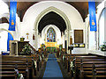
St Margaret, Drayton, Norfolk - East end
Image: © John Salmon
Taken: 10 Sep 2005
0.22 miles