
IMAGES TAKEN NEAR TO
Costessey Lane, NORWICH, NR8 6HB
Introduction
This page details the photographs taken nearby to Costessey Lane, NR8 6HB by members of the Geograph project.
The Geograph project started in 2005 with the aim of publishing, organising and preserving representative images for every square kilometre of Great Britain, Ireland and the Isle of Man.

There are currently over 7.5m images from over14,400 individuals and you can help contribute to the project by visiting https://www.geograph.org.uk
Image Map
Images are licensed for reuse under creativecommons.org/licenses/by-sa/2.0
Notes
- Clicking on the map will re-center to the selected point.
- The higher the marker number, the further away the image location is from the centre of the postcode.
Image Listing (34 Images Found)
Images are licensed for reuse under creativecommons.org/licenses/by-sa/2.0
Image
Details
Distance
1

Bin day in Station Road
The Themelthorpe to Norwich Railway was built in 1882; the railway trackbed now forms part of the Marriott's Way long distance path and cycleway and the station has long since closed. Station Road is an unsurfaced no-through road, serving as access to adjoining buildings only.
Image: © Evelyn Simak
Taken: 14 Mar 2014
0.09 miles
2
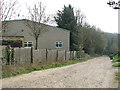
View along Station Road
The Themelthorpe to Norwich Railway was built in 1882; the railway trackbed now forms part of the Marriott's Way long distance path and cycleway and the station has long since closed. Station Road is an unsurfaced no-through road, serving as access to adjoining buildings only.
Image: © Evelyn Simak
Taken: 14 Mar 2014
0.09 miles
3
Industrial building beside Station Road
The Themelthorpe to Norwich Railway was built in 1882; the railway trackbed now forms part of the Marriott's Way long distance path and cycleway and the station has long since closed. Station Road is an unsurfaced no-through road, serving as access to adjoining buildings only.
Image: © Evelyn Simak
Taken: 14 Mar 2014
0.09 miles


7
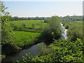
River Wensum
From the old railway bridge.
Image: © Hugh Venables
Taken: 15 May 2018
0.11 miles
8

Industrial buildings beside Station Road
The Themelthorpe to Norwich Railway was built in 1882; the railway trackbed now forms part of the Marriott's Way long distance path and cycleway and the station has long since closed. Station Road is an unsurfaced no-through road, serving as access to adjoining buildings only.
Image: © Evelyn Simak
Taken: 14 Mar 2014
0.11 miles
9
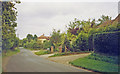
Drayton (Norfolk): near site of station, 1993
View westward on Costessey Road by Station Road: the station had been up to the right and here the ex-Midland & Great Northern branch Melton Constable (left) - Norwich City (right) had crossed here - until 2/3/59 when almost all the M&GN system was closed wholesale.
Image: © Ben Brooksbank
Taken: 4 Sep 1993
0.11 miles
10

Marriott's Way in woodland near Drayton
Image: © David Smith
Taken: 8 Jun 2024
0.11 miles