
IMAGES TAKEN NEAR TO
Fleet Road, NORWICH, NR8 5BH
Introduction
This page details the photographs taken nearby to Fleet Road, NR8 5BH by members of the Geograph project.
The Geograph project started in 2005 with the aim of publishing, organising and preserving representative images for every square kilometre of Great Britain, Ireland and the Isle of Man.

There are currently over 7.5m images from over14,400 individuals and you can help contribute to the project by visiting https://www.geograph.org.uk
Image Map
Images are licensed for reuse under creativecommons.org/licenses/by-sa/2.0
Notes
- Clicking on the map will re-center to the selected point.
- The higher the marker number, the further away the image location is from the centre of the postcode.
Image Listing (12 Images Found)
Images are licensed for reuse under creativecommons.org/licenses/by-sa/2.0
Image
Details
Distance
1
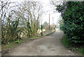
View along Fleet Road
Fleet Road is a private road.
Image: © Evelyn Simak
Taken: 14 Mar 2014
0.08 miles
4
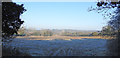
Frost on the field at Taverham
Taverham Hall (Langley) School can just be made out mid-centre
Zoom https://www.geograph.org.uk/photo/6029090
Image: © Adrian S Pye
Taken: 20 Jan 2019
0.15 miles
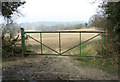

7
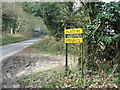
Junction of Fleet Road and Ringland Lane
Image: © Evelyn Simak
Taken: 14 Mar 2014
0.19 miles
8

Butterfly on the boardwalk, Taverham Mill
A small tortoiseshell, Aglais urticae on the walk between the River Wensum and the fishing lake and woodland. Taverham Mill is owned by Anglian Water and consists of a nature trail, fishing lakes, café, visitors' centre, tackle shop and playground. The nature trail covers over 100 acres and includes a stretch of the River Wensum. It is on the site of a paper mill which opened in the 18th century and closed at the end of the 19th century. None of the mill buildings survive.
Image: © pam fray
Taken: 13 Jul 2021
0.19 miles

