IMAGES TAKEN NEAR TO
Aslake Close, NORWICH, NR7 8DG

Introduction

This page details the photographs taken nearby to Aslake Close, NR7 8DG by members of the Geograph project.

The Geograph project started in 2005 with the aim of publishing, organising and preserving representative images for every square kilometre of Great Britain, Ireland and the Isle of Man.

There are currently over 7.5m images from over14,400 individuals and you can help contribute to the project by visiting https://www.geograph.org.uk

Image Map


Images are licensed for reuse under creativecommons.org/licenses/by-sa/2.0
Notes
  • Clicking on the map will re-center to the selected point.
  • The higher the marker number, the further away the image location is from the centre of the postcode.

Image Listing (90 Images Found)

Images are licensed for reuse under creativecommons.org/licenses/by-sa/2.0
  • ...
Image
Details
Distance
1
Two GP Surgeries, Aslake Close
Image: © Paul Shreeve Taken: 19 Mar 2009
0.00 miles
2
Church Green Flats, Aslake Close
Image: © Paul Shreeve Taken: 19 Mar 2009
0.02 miles
3
Norfolk Learning Difficulties Service, Aslake Close
Image: © Paul Shreeve Taken: 19 Mar 2009
0.03 miles
4
Chemist's Aslake Close
Image: © Paul Shreeve Taken: 19 Mar 2009
0.04 miles
5
Church Green Lodge
Image: © Paul Shreeve Taken: 19 Mar 2009
0.04 miles
6
Sprowston Day Services, Aslake Close
Image: © Paul Shreeve Taken: 19 Mar 2009
0.05 miles
7
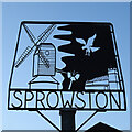
Sprowston village sign
The sign shows the old postmill, so often painted by John Crome, before it was destroyed by fire in 1933. The church of St Margaret nestles in the bottom corner and above is the emblem of the Corbett family a Raven or Corvus corax, otherwise called a corbie. https://www.geograph.org.uk/photo/6689828
Image: © Adrian S Pye Taken: 26 Nov 2020
0.10 miles
8
Sprowston village sign
The sign shows the old postmill, so often painted by John Crome, before it was destroyed by fire in 1933. The church of St Margaret nestles in the bottom corner and above is the emblem of the Corbett family a Raven or Corvus corax, otherwise called a corbie. https://www.geograph.org.uk/photo/6689825
Image: © Adrian S Pye Taken: 26 Nov 2020
0.10 miles
9
Old Milestone
Old milestone on the A.1151 at Sprowston, Norfolk. For close up view see http://www.geograph.org.uk/photo/1361649
Image: © Keith Evans Taken: 11 Jun 2009
0.11 miles
10
Old Milestone on the A1151, Wroxham Road, Sprowston
Carved stone post by the A1151, in parish of Sprowston (Broadland District), Wroxham Road, by No. 188, in pavement against brick wall, on South East side of road. Erected by an unknown authority in the 19th century. Inscription reads:- TO NORWICH 2 MILES WROXHAM 5 MILES SPROWSTON Carved benchmark on top front. Norfolk HER. NHER Number: 56639 https://www.heritagegateway.org.uk/Gateway/Results_Single.aspx?uid=MNF63062&resourceID=1002 Milestone Society National ID: NO_NWR2
Image: © CW Haines Taken: 18 Oct 2002
0.12 miles
  • ...