IMAGES TAKEN NEAR TO
Blue Boar Lane, NORWICH, NR7 8AB
Introduction
This page details the photographs taken nearby to Blue Boar Lane, NR7 8AB by members of the Geograph project.
The Geograph project started in 2005 with the aim of publishing, organising and preserving representative images for every square kilometre of Great Britain, Ireland and the Isle of Man.

There are currently over 7.5m images from over14,400 individuals and you can help contribute to the project by visiting https://www.geograph.org.uk
Image Map
Images are licensed for reuse under creativecommons.org/licenses/by-sa/2.0
Notes
- Clicking on the map will re-center to the selected point.
- The higher the marker number, the further away the image location is from the centre of the postcode.
Image Listing (10 Images Found)
Images are licensed for reuse under creativecommons.org/licenses/by-sa/2.0
Image
Details
Distance
1
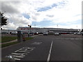
Tesco Extra Superstore, Blue Boar, Norwich
Off Blue Boar Lane
Image: © Geographer
Taken: 15 Oct 2014
0.03 miles
2
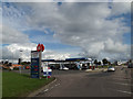
Tesco Extra Fuel Filling Station, Blue Boar, Norwich
Off Blue Boar Lane
Image: © Geographer
Taken: 15 Oct 2014
0.07 miles
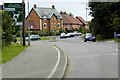
3
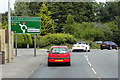
Wroxham Road Approaching the Blue Boar Roundabout
Image: © David Dixon
Taken: 7 Aug 2015
0.20 miles
4
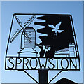
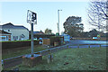
Sprowston village sign
The sign shows the old postmill, so often painted by John Crome, before it was destroyed by fire in 1933. The church of St Margaret nestles in the bottom corner and above is the emblem of the Corbett family a Raven or Corvus corax, otherwise called a corbie. https://www.geograph.org.uk/photo/6689828
Image: © Adrian S Pye
Taken: 26 Nov 2020
0.21 miles
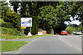
5
Sprowston village sign
The sign shows the old postmill, so often painted by John Crome, before it was destroyed by fire in 1933. The church of St Margaret nestles in the bottom corner and above is the emblem of the Corbett family a Raven or Corvus corax, otherwise called a corbie. https://www.geograph.org.uk/photo/6689825
Image: © Adrian S Pye
Taken: 26 Nov 2020
0.21 miles
9
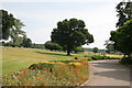
Sprowston Park
A view of Sprowston Park looking towards Sprowston Park Golf Club (one of Norwich premier golf courses)
Image: © Margot Thornley
Taken: 2 Jul 2006
0.24 miles
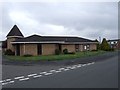
10
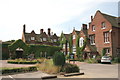
Sprowston Manor
Sprowston Manor situated in Sprowston Park, next to Sprowston Park Golf Club, owned and run by the Marriott Hotels Group.
Image: © Margot Thornley
Taken: 2 Jul 2006
0.24 miles