
IMAGES TAKEN NEAR TO
St. Andrews Avenue, NORWICH, NR7 0RG
Introduction
This page details the photographs taken nearby to St. Andrews Avenue, NR7 0RG by members of the Geograph project.
The Geograph project started in 2005 with the aim of publishing, organising and preserving representative images for every square kilometre of Great Britain, Ireland and the Isle of Man.

There are currently over 7.5m images from over14,400 individuals and you can help contribute to the project by visiting https://www.geograph.org.uk
Image Map
Images are licensed for reuse under creativecommons.org/licenses/by-sa/2.0
Notes
- Clicking on the map will re-center to the selected point.
- The higher the marker number, the further away the image location is from the centre of the postcode.
Image Listing (47 Images Found)
Images are licensed for reuse under creativecommons.org/licenses/by-sa/2.0
Image
Details
Distance
1

Scarecrows, Yarmouth Road (A1242), Thorpe St Andrew
Part of the Thorpe St. Andrew Scarecrow Trail.
Image: © habiloid
Taken: 25 May 2026
0.10 miles
3
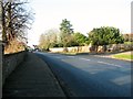
Yarmouth Road (A1242) through Thorpe St Andrew
Thorpe cemetery lies behind the wall seen at left.
Image: © Evelyn Simak
Taken: 17 Feb 2018
0.11 miles
4
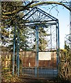
Entrance gate to Yarmouth Road cemetery
The cemetery is also known as Thorpe cemetery and this was the entrance into the eastern section which until 1903 had been used by the Norfolk Lunatic Asylum. All the asylum's graves have been re-used and the dead buried in them are now anonymous. The cemetery was opened in 1859. The two acres of land had been purchased for £500, with half the amount having been raised by voluntary rate and the remainder was contributed from the funds of the Lunatic Asylum, situated a short distance further to the east, to which one acre was appropriated. The two sections are separated by a low brick wall.
Image: © Evelyn Simak
Taken: 17 Feb 2018
0.11 miles
5
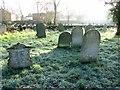
Frosty headstones in Thorpe cemetery
The area occupied by the houses seen in the background used to be allotment gardens.
Image: © Evelyn Simak
Taken: 17 Feb 2018
0.12 miles
6
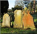
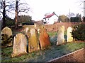
A trio of 19th century headstones in Thorpe cemetery
Image: © Evelyn Simak
Taken: 17 Feb 2018
0.12 miles
7
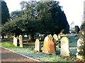
Old gravestones in Thorpe Cemetery
The cemetery was opened in 1859. The two acres of land had been purchased for £500, with half the amount having been raised by voluntary rate and the remainder was contributed from the funds of the Lunatic Asylum, situated a short distance further to the east, to which one acre was appropriated. The asylum buried its dead there until 1903 and the old graves have since been re-used.
Image: © Evelyn Simak
Taken: 17 Feb 2018
0.12 miles
8
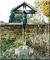
The grave of Honor and William Reginald Devenish
In Thorpe cemetery. For a close view of the plaques at the foot of the cross see > http://www.geograph.org.uk/photo/5682140.
Image: © Evelyn Simak
Taken: 17 Feb 2018
0.12 miles
9
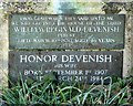
Plaques on the grave of Honor and William Reginald Devenish
For a full view of the grave see > http://www.geograph.org.uk/photo/5682139.
Image: © Evelyn Simak
Taken: 17 Feb 2018
0.12 miles
10
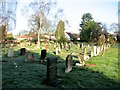
View across the eastern section of Thorpe cemetery
Until 1903, the eastern section had been used by the Norfolk Lunatic Asylum. All the asylum's graves have since been re-used and the dead buried in them are now anonymous. The cemetery was opened in 1859. The two acres of land had been purchased for £500, with half the amount having been raised by voluntary rate and the remainder was contributed from the funds of the Lunatic Asylum, situated a short distance further to the east, to which one acre was appropriated. The two sections are separated by a low brick wall.
Image: © Evelyn Simak
Taken: 17 Feb 2018
0.12 miles