1
Yarmouth Road (A1242) through Thorpe St Andrew
Thorpe cemetery lies behind the wall seen at left.
Image: © Evelyn Simak
Taken: 17 Feb 2018
0.17 miles
2
Graves in Thorpe cemetery
Image: © Evelyn Simak
Taken: 17 Feb 2018
0.19 miles
3
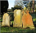
A trio of 19th century headstones in Thorpe cemetery
Image: © Evelyn Simak
Taken: 17 Feb 2018
0.19 miles
4
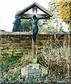
Unusual headstone by the junction of paths in Thorpe cemetery
Image: © Evelyn Simak
Taken: 17 Feb 2018
0.19 miles
5
19th century gravestones in Thorpe cemetery
The cemetery was opened in 1859. The two acres of land had been purchased for £500, with half the amount having been raised by voluntary rate and the remainder was contributed from the funds of the Lunatic Asylum, situated a short distance further to the east, to which one acre was appropriated. The asylum buried its dead there until 1903 and the old graves have since been re-used.
Image: © Evelyn Simak
Taken: 17 Feb 2018
0.19 miles
6
River Green, Thorpe St Andrew
Church and shops facing the River Yare
Image: © Gareth Hughes
Taken: 15 Aug 2005
0.19 miles
7
Plaques on the grave of Honor and William Reginald Devenish
For a full view of the grave see > http://www.geograph.org.uk/photo/5682139.
Image: © Evelyn Simak
Taken: 17 Feb 2018
0.20 miles
8
The grave of Honor and William Reginald Devenish
In Thorpe cemetery. For a close view of the plaques at the foot of the cross see > http://www.geograph.org.uk/photo/5682140.
Image: © Evelyn Simak
Taken: 17 Feb 2018
0.20 miles
9
Old gravestones in Thorpe Cemetery
The cemetery was opened in 1859. The two acres of land had been purchased for £500, with half the amount having been raised by voluntary rate and the remainder was contributed from the funds of the Lunatic Asylum, situated a short distance further to the east, to which one acre was appropriated. The asylum buried its dead there until 1903 and the old graves have since been re-used.
Image: © Evelyn Simak
Taken: 17 Feb 2018
0.20 miles
10
High grass between the graves in Thorpe cemetery
The cemetery was opened in 1859. The two acres of land had been purchased for £500, with half the amount having been raised by voluntary rate and the remainder was contributed from the funds of the Lunatic Asylum, situated a short distance further to the east, to which one acre was appropriated. The asylum buried its dead there until 1903 and the old graves have since been re-used.
Image: © Evelyn Simak
Taken: 17 Feb 2018
0.20 miles


