
IMAGES TAKEN NEAR TO
Harvey Lane, NORWICH, NR7 0BQ
Introduction
This page details the photographs taken nearby to Harvey Lane, NR7 0BQ by members of the Geograph project.
The Geograph project started in 2005 with the aim of publishing, organising and preserving representative images for every square kilometre of Great Britain, Ireland and the Isle of Man.

There are currently over 7.5m images from over14,400 individuals and you can help contribute to the project by visiting https://www.geograph.org.uk
Image Map
Images are licensed for reuse under creativecommons.org/licenses/by-sa/2.0
Notes
- Clicking on the map will re-center to the selected point.
- The higher the marker number, the further away the image location is from the centre of the postcode.
Image Listing (159 Images Found)
Images are licensed for reuse under creativecommons.org/licenses/by-sa/2.0
Image
Details
Distance
1
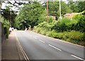
View north along Harvey Lane
Approaching the junction with Stanley Avenue.
Image: © Evelyn Simak
Taken: 25 Jun 2019
0.02 miles
2
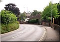
View downhill along Harvey Lane
On the approach to the Thorpe Road junction.
Image: © Evelyn Simak
Taken: 25 Jun 2019
0.03 miles
3
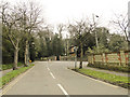
Road junction in Norwich, with Harvey Lane ahead
Image: © Adrian S Pye
Taken: 18 Feb 2011
0.04 miles
4
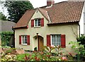
1930s house at the eastern end of Stanley Avenue
Stanley Avenue forms a loop from Thorpe Road to Harvey Lane. The road was constructed in the early 1870s but it took until the 1890s before some houses were built, the first of these at the corner. Most other houses date from the 1930s.
Image: © Evelyn Simak
Taken: 25 Jun 2019
0.04 miles
5
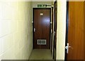
Broadland District Council Emergency Centre - corridor
The corridor on the lower level with a number of doors on each side, leading to the kitchen, toilet, sleeping and storage rooms and also to the emergency exit.
Image: © Evelyn Simak
Taken: 14 Mar 2019
0.04 miles
6

Broadland District Council Emergency Centre - emergency exit
Steel ladder leading up from the lower level to a steel hatch at groundlevel if no other exit is possible. The hatch is being serviced at regular intervals and kept fully functional. For a view of the entrance, which is protected by a heavy steel door, see > https://www.geograph.org.uk/photo/6087648.
Image: © Evelyn Simak
Taken: 14 Mar 2019
0.04 miles
7
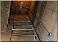
Broadland District Council Emergency Centre - emergency exit
Steel ladder leading up from the lower level to a steel hatch at groundlevel if no other exit is possible. The hatch is being serviced at regular intervals and kept fully functional. For an external view see > https://www.geograph.org.uk/photo/6087651.
Image: © Evelyn Simak
Taken: 14 Mar 2019
0.04 miles
9

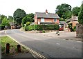
Houses in Harvey Lane
For a closer look of the topiary see > https://www.geograph.org.uk/photo/6193016.
Image: © Evelyn Simak
Taken: 25 Jun 2019
0.04 miles
10

Topiary beside the Eden Close road sign
See > https://www.geograph.org.uk/photo/6193015 for a wider view of this location.
Image: © Evelyn Simak
Taken: 25 Jun 2019
0.04 miles