
IMAGES TAKEN NEAR TO
Harvey Lane, NORWICH, NR7 0BN
Introduction
This page details the photographs taken nearby to Harvey Lane, NR7 0BN by members of the Geograph project.
The Geograph project started in 2005 with the aim of publishing, organising and preserving representative images for every square kilometre of Great Britain, Ireland and the Isle of Man.

There are currently over 7.5m images from over14,400 individuals and you can help contribute to the project by visiting https://www.geograph.org.uk
Image Map
Images are licensed for reuse under creativecommons.org/licenses/by-sa/2.0
Notes
- Clicking on the map will re-center to the selected point.
- The higher the marker number, the further away the image location is from the centre of the postcode.
Image Listing (77 Images Found)
Images are licensed for reuse under creativecommons.org/licenses/by-sa/2.0
Image
Details
Distance
1
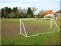
Cottages by playing field, School Lane
Image: © Evelyn Simak
Taken: 10 Mar 2012
0.08 miles
2
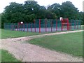
Games Court, Woodrow Pilling Park, Norwich
Image: © Alex McGregor
Taken: 28 Jun 2011
0.08 miles
3

Pinebanks from the folly
Pinebanks house (at the time, a sports club, now closed and with an uncertain future) seen from the top of the folly while it was under repair. The northern suburbs of Norwich spread out beyond.
Image: © Gareth Hughes
Taken: 30 Jan 2007
0.12 miles
4

Pinebanks Tower
A clearer view of the Victorian folly in the grounds of Pinebanks.
Image: © Gareth Hughes
Taken: 14 Jun 2006
0.12 miles
5
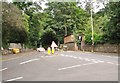
Temporary traffic lights on Harvey Lane
By the junction with Stanley Avenue.
Image: © Evelyn Simak
Taken: 25 Jun 2019
0.14 miles
6

Pinebanks, Thorpe St Andrew
The west elevation, showing some of the additions made when the house became a sports club. Despite these, the original Victorian building survives largely intact. It is currently empty and in need of a new use.
Update: Destroyed by fire in the summer of 2014
Image: © Gareth Hughes
Taken: Unknown
0.15 miles
7

Two Towers, Pinebanks
The tower of Pinebanks house seen beyond the base of the folly tower in the grounds. Both were built c.1880 for John Odin Taylor, possibly to designs by Thomas Jeckyll.
Image: © Gareth Hughes
Taken: 14 Jun 2006
0.15 miles
8
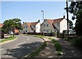
2/4 and 6/8 Morse Road
Morse Road is named after George Morse, the first Mayor and then Lord Mayor of Norwich. He was a brewer by trade and the director of Stuart & Pattersons brewery. He was also a mountaineer of some repute.
Image: © Evelyn Simak
Taken: 29 Jun 2019
0.16 miles
9
Road junction in Norwich, with Harvey Lane ahead
Image: © Adrian S Pye
Taken: 18 Feb 2011
0.17 miles
10
View north along Harvey Lane
Approaching the junction with Stanley Avenue.
Image: © Evelyn Simak
Taken: 25 Jun 2019
0.17 miles