IMAGES TAKEN NEAR TO
Spixworth Road, NORWICH, NR6 7EH

Introduction

This page details the photographs taken nearby to Spixworth Road, NR6 7EH by members of the Geograph project.

The Geograph project started in 2005 with the aim of publishing, organising and preserving representative images for every square kilometre of Great Britain, Ireland and the Isle of Man.

There are currently over 7.5m images from over14,400 individuals and you can help contribute to the project by visiting https://www.geograph.org.uk

Image Map


Images are licensed for reuse under creativecommons.org/licenses/by-sa/2.0
Notes
  • Clicking on the map will re-center to the selected point.
  • The higher the marker number, the further away the image location is from the centre of the postcode.

Image Listing (11 Images Found)

Images are licensed for reuse under creativecommons.org/licenses/by-sa/2.0
Image
Details
Distance
1
The War Memorial wall at Old Catton
The Memorial backs onto the Deer Park. It bears 17 names from WW1 and 18 from WW2.
Image: © Adrian S Pye Taken: 15 Jul 2015
0.14 miles
2
Old Catton Village Hall
Rather grand for a village hall, it started life as an Orangery in the grounds of Catton Hall, tacked onto the buildings of the Home Farm
Image: © Gareth Hughes Taken: Unknown
0.15 miles
3
Old Catton village sign
Old Catton village sign (a cat atop a beer keg) at the junction of Parkside Drive with Church Street.
Image: © Margot Thornley Taken: 3 Jun 2006
0.15 miles
4
St Margaret's Church and Graveyard
St Margarets Church Old Catton showing part of the graveyard fronting onto Church Street.
Image: © Margot Thornley Taken: 21 May 2006
0.15 miles
5
Old Catton War Memorial
A memorial to those of Old Catton who lost their lives (For Your Tomorrow, They Gave Their Today) in the 'Great War' 1914-18 and the 'Second World War' 1939-45.
Image: © Margot Thornley Taken: 21 May 2006
0.18 miles
6
Catton Park
Image: © Stuart Shepherd Taken: 1 Jan 2019
0.20 miles
7
Road from St Margaret's Church, Catton, Norfolk
Image: © John Salmon Taken: 14 Jun 2008
0.24 miles
8
Church Street through Old Catton
For the duration of the Second World War the Old Catton village sign stood in front of the RAF Horsham St Faith Officers' Mess in Fifers Lane: http://oldcattonsociety.org.uk/village-sign Although nowadays considered a suburb of the city of Norwich, the residents of Old Catton prefer to still regard it as a village. Old Catton covers an area of 211 hectares and, as evidenced by archaeological finds, its history dates back to the Stone Age; documented history begins in 1086 with the Domesday Book. In more recent times the author Anna Sewell wrote her book "Black Beauty" while living at Old Catton.
Image: © Evelyn Simak Taken: 4 Feb 2008
0.24 miles
9
Old Catton sign
Image: © John Salmon Taken: 14 Jun 2008
0.24 miles
10
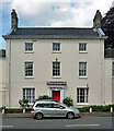
81 Spixworth Road, Old Catton
A well-proportioned late C18th house in three bays and storeys with a good doorcase (Image]). Grade II listed.
Image: © Stephen Richards Taken: 21 Jun 2016
0.24 miles