IMAGES TAKEN NEAR TO
Bush Road, NORWICH, NR6 6UD
Introduction
This page details the photographs taken nearby to Bush Road, NR6 6UD by members of the Geograph project.
The Geograph project started in 2005 with the aim of publishing, organising and preserving representative images for every square kilometre of Great Britain, Ireland and the Isle of Man.

There are currently over 7.5m images from over14,400 individuals and you can help contribute to the project by visiting https://www.geograph.org.uk
Image Map
Images are licensed for reuse under creativecommons.org/licenses/by-sa/2.0
Notes
- Clicking on the map will re-center to the selected point.
- The higher the marker number, the further away the image location is from the centre of the postcode.
Image Listing (10 Images Found)
Images are licensed for reuse under creativecommons.org/licenses/by-sa/2.0
Image
Details
Distance
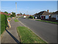
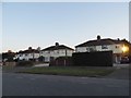
1
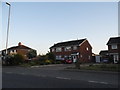
The first houses in Norwich
Coming in from the north, the start of suburban Norwich on Holt Road
Image: © David Howard
Taken: 31 May 2017
0.05 miles
2
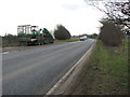
Approaching Norwich from the north
View south along the A140 past Norwich Airport.
Image: © Evelyn Simak
Taken: 9 Mar 2009
0.06 miles
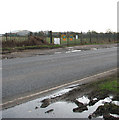
3
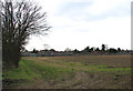
Allotments beside the A140
These allotments are located by the A140, opposite the Norwich Airport.
Image: © Evelyn Simak
Taken: 9 Mar 2009
0.08 miles
5

RAF Bulldog
An ex Royal Air Force, Scottish Aviation manufactured, Bulldog rests awaiting a new life at Norwich International Airport.
Image: © DI Wyman
Taken: 30 May 2007
0.13 miles
6
Emergency entrance to Norwich Airfield
This view was taken from across the A140. Norwich International is located 4 miles outside Norwich City centre. It serves Norfolk, Suffolk and North Cambridgeshire, a catchment area consisting of 1.5 million people. The airport offers a range of leisure destinations during the summer and currently has a throughput of over 460,000 passengers per year . Opened in 1933 as the civil airport at Mousehold (a small community to the north of the city) and originally little more than a general aviation facility, it was taken over by the Royal Air Force at the beginning of the war. In 1967, Norfolk County Council and Norwich City Council bought the Royal Air Force airfield at Horsham St Faiths and the intervening land and a three-stage development plan was launched. By 1969 the fuel supply service became operational and in 1970 the Customs authorities granted approval for the export and import of all types of freight. Later that year a Plessey ACR 430 radar system was installed and holiday charter flights started during the following year. Norwich Airport was included in internal UK night mail operations at an early stage and in the late 1987 Norwich Airport became a limited company.
Image: © Evelyn Simak
Taken: 9 Mar 2009
0.14 miles
8
Norwich Airport
Viewed from the A140. The control tower can be seen in the distance (in adjacent grid square). Norwich International is located 4 miles outside Norwich City centre. It serves Norfolk, Suffolk and North Cambridgeshire, a catchment area consisting of 1.5 million people. The airport offers a range of leisure destinations during the summer and currently has a throughput of over 460,000 passengers per year . Opened in 1933 as the civil airport at Mousehold (a small community to the north of the city) and originally little more than a general aviation facility, it was taken over by the Royal Air Force at the beginning of the war. In 1967, Norfolk County Council and Norwich City Council bought the Royal Air Force airfield at Horsham St Faiths and the intervening land and a three-stage development plan was launched. By 1969 the fuel supply service became operational and in 1970 the Customs authorities granted approval for the export and import of all types of freight. Later that year a Plessey ACR 430 radar system was installed and holiday charter flights started during the following year. Norwich Airport was included in internal UK night mail operations at an early stage and in the late 1987 Norwich Airport became a limited company.
Image: © Evelyn Simak
Taken: 9 Mar 2009
0.18 miles
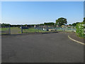
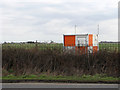
10
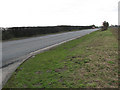
View south along the A140
The hedgerow obscures the view to Norwich Airport.
Image: © Evelyn Simak
Taken: 9 Mar 2009
0.23 miles