
IMAGES TAKEN NEAR TO
Oval Road, NORWICH, NR5 0DG
Introduction
This page details the photographs taken nearby to Oval Road, NR5 0DG by members of the Geograph project.
The Geograph project started in 2005 with the aim of publishing, organising and preserving representative images for every square kilometre of Great Britain, Ireland and the Isle of Man.

There are currently over 7.5m images from over14,400 individuals and you can help contribute to the project by visiting https://www.geograph.org.uk
Image Map
Images are licensed for reuse under creativecommons.org/licenses/by-sa/2.0
Notes
- Clicking on the map will re-center to the selected point.
- The higher the marker number, the further away the image location is from the centre of the postcode.
Image Listing (37 Images Found)
Images are licensed for reuse under creativecommons.org/licenses/by-sa/2.0
Image
Details
Distance
1
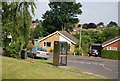
Telephone box, corner of Winsford Way and Woodhill Rise
Image: © N Chadwick
Taken: 1 Jul 2010
0.04 miles
7
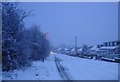
Gunton Lane in winter
About half of this grid square is built up with houses similar to these; the other half (behind the trees on the left) is fields on which horses graze.
Image: © Richard Kennaway
Taken: 29 Dec 2005
0.11 miles
9

Marriott's Way towards Norwich
Marriott's Way is a 26 mile footpath, bridleway and cycle route which follows the routes of two disused railway lines, running between Aylsham and Norwich. The route is named after the chief engineer and manager of the Midland and Great Northern Railway system William Marriott.
Image: © JThomas
Taken: 1 Jun 2025
0.14 miles
10
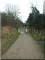
Marriott's Way, Costessey
Looking south from the entry point at Gunton Lane. Path info: http://www.countrysideaccess.norfolk.gov.uk/walk-35.asp?id=35
Image: © Katy Walters
Taken: 11 Feb 2006
0.14 miles