
IMAGES TAKEN NEAR TO
Hall Road, NORWICH, NR4 6EG
Introduction
This page details the photographs taken nearby to Hall Road, NR4 6EG by members of the Geograph project.
The Geograph project started in 2005 with the aim of publishing, organising and preserving representative images for every square kilometre of Great Britain, Ireland and the Isle of Man.

There are currently over 7.5m images from over14,400 individuals and you can help contribute to the project by visiting https://www.geograph.org.uk
Image Map
Images are licensed for reuse under creativecommons.org/licenses/by-sa/2.0
Notes
- Clicking on the map will re-center to the selected point.
- The higher the marker number, the further away the image location is from the centre of the postcode.
Image Listing (86 Images Found)
Images are licensed for reuse under creativecommons.org/licenses/by-sa/2.0
Image
Details
Distance
1

B&Q Superstore, Hall Road, Norwich
Norwich Cattle Market was moved to this site in 1960: eventually most of the site was redeveloped, and the B&Q store opened a couple of years ago.
Image: © Paul Shreeve
Taken: 20 Feb 2008
0.01 miles
2
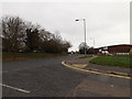
Hall Road, Keswick
At the junction with Old Hall Road
Image: © Geographer
Taken: 3 Dec 2014
0.03 miles
3
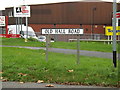
Old Hall Road sign
On Old Hall Road at the junction with Hall Road
Image: © Geographer
Taken: 3 Dec 2014
0.03 miles
4
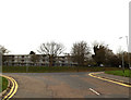
Old Hall Road, Keswick
At the junction with Hall Road
Image: © Geographer
Taken: 3 Dec 2014
0.04 miles
5
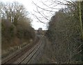
Railway Cutting, Norwich to Cambridge Line, Harford Bridge
This cutting takes the Norwich to Cambridge railway line from passing under Six Bridges viaduct (just visible in distance), and goes under the A140 Ipswich to Norwich road.
Image: © Paul Shreeve
Taken: 1 Mar 2008
0.06 miles
6
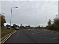
Hall Road, Keswick
Approaching the roundabout
Road No.C820
Image: © Geographer
Taken: 29 Oct 2014
0.06 miles
7

Hartwell's Vauxhall Showroom and Garage
This car showroom is on the corner of Ipswich Road and Hall Road, facing the Holiday Inn.
Image: © Paul Shreeve
Taken: 20 Feb 2008
0.06 miles
8

Holiday Inn Hotel, Hall Road/Ipswich Road junction
This hotel was built on allotment gardens in the 1960s. It has been through numerous name changes, including the Post House, but is now the Holiday Inn.
Image: © Paul Shreeve
Taken: 20 Feb 2008
0.06 miles
9

Housing infill, South Tuckswood
Kirklees was built on allotments between the hotel and South Tuckswood estate in the 1970s.
Image: © Paul Shreeve
Taken: 20 Feb 2008
0.07 miles
10
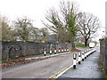
Bridge over the railway
This bridge takes Oldhall Road over the Norwich to Ely/Cambridge railway line. Oldhall Road is a very short lane leading to a new business development called Yarefield Park. It turns off the A140 (Ipswich Road) and reconnects with it a couple of 100 yards further along.
Image: © Evelyn Simak
Taken: 19 Jan 2010
0.08 miles