
IMAGES TAKEN NEAR TO
Norwich Road, BUNGAY, NR35 2JN
Introduction
This page details the photographs taken nearby to Norwich Road, NR35 2JN by members of the Geograph project.
The Geograph project started in 2005 with the aim of publishing, organising and preserving representative images for every square kilometre of Great Britain, Ireland and the Isle of Man.

There are currently over 7.5m images from over14,400 individuals and you can help contribute to the project by visiting https://www.geograph.org.uk
Image Map
Images are licensed for reuse under creativecommons.org/licenses/by-sa/2.0
Notes
- Clicking on the map will re-center to the selected point.
- The higher the marker number, the further away the image location is from the centre of the postcode.
Image Listing (14 Images Found)
Images are licensed for reuse under creativecommons.org/licenses/by-sa/2.0
Image
Details
Distance
1

Footpath
Footpath near to Ditchingham, Norfolk.
Image: © Keith Evans
Taken: 1 May 2014
0.06 miles
2

Old Gate
Old gate near to Ditchingham, Norfolk.
Image: © Keith Evans
Taken: 1 May 2014
0.06 miles
3

Waveney Valley near Ditchingham Lodge
The Angles Way/Bigod Way footpath follows the top of the valley with a steep drop to the valley floor below. For some reason this point has a sign stating that this is ‘Jacks Drop Off’.
Image: © Glen Denny
Taken: 14 Nov 2010
0.07 miles
4

Ditchingham Lodge
A glimpse of Ditchingham Lodge glimpsed from the River Waveney.
Image: © Linda Bailey
Taken: 18 Aug 2006
0.09 miles
5

Waveney Valley near Ditchingham Lodge
The Angles Way/Bigod Way footpath climbs up from the valley floor to follow the edge of the valley. Below can be seen the private road leading to Ditchingham Lodge with the River Waveney in the middle background.
Image: © Glen Denny
Taken: 14 Nov 2010
0.12 miles
6

Field near Bigod Way
Bigod Way is a path which loops around Bungay. This was taken from the path, looking onto fields above Ditchingham Lodge.
Image: © Linda Bailey
Taken: 16 Aug 2006
0.13 miles
7
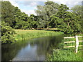
The Waveney at Outney Common, Bungay
The Norfolk Suffolk border runs along the Waveney at this point, it is also the parish boundary with Ditchingham on the north side and Bungay on the south.
Image: © Roger Jones
Taken: 30 Jul 2017
0.13 miles
8
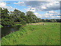
The Waveney at Outney Common, Bungay (4)
The Norfolk Suffolk border runs along the Waveney at this point, it is also the parish boundary with Ditchingham on the north side and Bungay on the south.
Image: © Roger Jones
Taken: 30 Jul 2017
0.14 miles
9
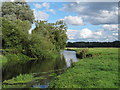
The Waveney at Outney Common, Bungay (3)
The Norfolk Suffolk border runs along the Waveney at this point, it is also the parish boundary with Ditchingham on the north side and Bungay on the south.
Image: © Roger Jones
Taken: 30 Jul 2017
0.14 miles
10

Fields near Ditchingham Lodge
These fields slope down towards the River Waveney valley floor.
Image: © Glen Denny
Taken: 14 Nov 2010
0.16 miles