
IMAGES TAKEN NEAR TO
Falcon Lane, BUNGAY, NR35 2JG
Introduction
This page details the photographs taken nearby to Falcon Lane, NR35 2JG by members of the Geograph project.
The Geograph project started in 2005 with the aim of publishing, organising and preserving representative images for every square kilometre of Great Britain, Ireland and the Isle of Man.

There are currently over 7.5m images from over14,400 individuals and you can help contribute to the project by visiting https://www.geograph.org.uk
Image Map
Images are licensed for reuse under creativecommons.org/licenses/by-sa/2.0
Notes
- Clicking on the map will re-center to the selected point.
- The higher the marker number, the further away the image location is from the centre of the postcode.
Image Listing (213 Images Found)
Images are licensed for reuse under creativecommons.org/licenses/by-sa/2.0
Image
Details
Distance
1

River Waveney and Falcon Meadow
Falcon Meadow is on the Ditchingham, Norfolk, side of the river. The orange plastic fencing is there to protect the work going on to make the footpath wheelchair-accessible.
Image: © Glen Denny
Taken: 27 Feb 2011
0.07 miles
2

Footpath improvement work at Falcon Meadow
The footpath across Falcon Meadow is being improved to make it suitable for disabled use, starting at the Bungay Sluice end and working towards Ditchingham Dam. To the right is the River Waveney and the Suffolk side of the river.
Image: © Glen Denny
Taken: 27 Feb 2011
0.08 miles
3

Boom across the River Waveney
This boom prevents canoeists from attempting to navigate the structure of Bungay Sluice, part of which can just been seen on the right. In the background is the Norfolk bank of the river at Falcon Meadow, Ditchingham.
Image: © Glen Denny
Taken: 27 Feb 2011
0.08 miles
4

Footpath improvement work at Falcon Meadow
The footpath across Falcon Meadow connects with the Suffolk side of the River Waveney via a footbridge. On the Suffolk side the footpath is wheelchair accessible and the Norfolk side is being improved to follow suit, starting at the Bungay Sluice end.
Image: © Glen Denny
Taken: 27 Feb 2011
0.08 miles
5

Footpath over Bungay Sluice on the River Waveney
Image: © Helen Steed
Taken: 26 Dec 2011
0.09 miles
6

Warning signs near Bungay Sluice
The River Waveney above Geldeston Locks is used by canoeists and portages have been provided at the various sluices. Behind the sign work is going on to improve the footpath for disabled use.
Image: © Glen Denny
Taken: 27 Feb 2011
0.09 miles
7

River Waveney at Falcon Meadow
This view is looking towards the point where the mill race for the watermill at Bungay Staithe leaves the main river.
Image: © Glen Denny
Taken: 27 Feb 2011
0.09 miles
8
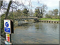
Sluice on the River Waveney at Bungay
Bungay was the head of navigation of the River Waveney but its current head of navigation is Geldeston locks. The Waveney is the most southerly of the Broadland rivers, running along the Norfolk - Suffolk border for much of its length.
Image: © Adrian S Pye
Taken: 28 Apr 2021
0.09 miles
9

Bungay Sluice
In front of the sluice is a boom across the River Waveney to prevent canoeists from attempting to navigate the sluice itself - there is a portage point just off to the right of this image. Hidden behind the sluice structure is a footbridge carrying the footpath across the river from Falcon Meadow to Bungay Staithe.
Image: © Glen Denny
Taken: 27 Feb 2011
0.09 miles
10
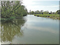
River Waveney looking west from the sluice
https://www.geograph.org.uk/photo/6822982
Image: © Adrian S Pye
Taken: 28 Apr 2021
0.10 miles