IMAGES TAKEN NEAR TO
Thwaite Road, BUNGAY, NR35 2EA
Introduction
This page details the photographs taken nearby to Thwaite Road, NR35 2EA by members of the Geograph project.
The Geograph project started in 2005 with the aim of publishing, organising and preserving representative images for every square kilometre of Great Britain, Ireland and the Isle of Man.

There are currently over 7.5m images from over14,400 individuals and you can help contribute to the project by visiting https://www.geograph.org.uk
Image Map
Images are licensed for reuse under creativecommons.org/licenses/by-sa/2.0
Notes
- Clicking on the map will re-center to the selected point.
- The higher the marker number, the further away the image location is from the centre of the postcode.
Image Listing (14 Images Found)
Images are licensed for reuse under creativecommons.org/licenses/by-sa/2.0
Image
Details
Distance
1
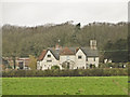
Tindall Hall from Tindall Road
Thwaite St. Mary
Image: © Adrian S Pye
Taken: 13 Feb 2011
0.07 miles
2
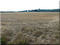
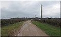
View across stubble towards Tindall Hall Cottages
Image: © Evelyn Simak
Taken: 4 Sep 2013
0.08 miles
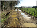
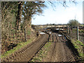
4
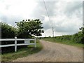
Entrance to Tindall Hall
Tindall Hall at Broome in Norfolk, is a working Dairy Farm and has a large premier herd of dairy cows. The Hall itself cannot easily be seen from the road.
Image: © Adrian S Pye
Taken: 30 Jun 2010
0.11 miles