
IMAGES TAKEN NEAR TO
Branford Road, NORWICH, NR3 4QD
Introduction
This page details the photographs taken nearby to Branford Road, NR3 4QD by members of the Geograph project.
The Geograph project started in 2005 with the aim of publishing, organising and preserving representative images for every square kilometre of Great Britain, Ireland and the Isle of Man.

There are currently over 7.5m images from over14,400 individuals and you can help contribute to the project by visiting https://www.geograph.org.uk
Image Map
Images are licensed for reuse under creativecommons.org/licenses/by-sa/2.0
Notes
- Clicking on the map will re-center to the selected point.
- The higher the marker number, the further away the image location is from the centre of the postcode.
Image Listing (38 Images Found)
Images are licensed for reuse under creativecommons.org/licenses/by-sa/2.0
Image
Details
Distance
2
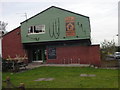
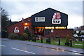
The Cidershed public house
The home of the Fat Cat brewery
Image: © Ian Bostle
Taken: 7 Feb 2008
0.06 miles
3
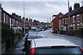
Sprowston Road, Norwich
A residential road on the northern side of Norwich. It is quite busy as it is a through road.
Image: © Bill Boaden
Taken: 30 Dec 2013
0.09 miles
4
Maurice Raes Close.
A (2007-08) housing development named after the Belgian pilot of that name whose aircraft crashed there in World War 2.
Image: © Ian Bostle
Taken: 24 Apr 2008
0.09 miles
5
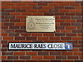
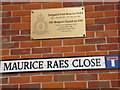
WW2 Memorial in Maurice Raes Close, Norwich
A bronze plaque placed above the road sign bearing his name commemorates Sergeant, Maurice Herman Marceun Raes, a spitfire pilot with 350 (Belgian) Squadron who, after completing a convoy patrol crashed close to this spot on his way back to this station at RAF Debden in Essex.
A wider view of the area: http://www.geograph.org.uk/photo/5675894
Full details of the accident:
http://www.aircrewremembered.com/raes-maurice-herman-marceun.html
Image: © Adrian S Pye
Taken: 10 Feb 2018
0.10 miles
6
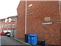
WW2 Memorial in Maurice Raes Close, Norwich
A bronze plaque placed above the road sign bearing his name commemorates Sergeant, Maurice Herman Marceun Raes, a spitfire pilot with 350 (Belgian) Squadron who, after completing a convoy patrol crashed close to this spot on his way back to this station at RAF Debden in Essex.
A close-up of the plaque: http://www.geograph.org.uk/photo/5675898
Full details of the accident:
http://www.aircrewremembered.com/raes-maurice-herman-marceun.html
Image: © Adrian S Pye
Taken: 10 Feb 2018
0.10 miles
7
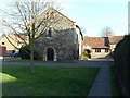
Lazar House, Norwich
The Lazar House was a Leper Hospital in the middle ages. It was outside the city wall, on the north side of the built up area of the time. In recent years it was a branch library, but was closed down due to cutbacks, and is now a community building.
Image: © Paul Shreeve
Taken: 27 Feb 2008
0.13 miles
8
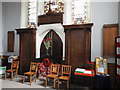
War Memorials in New Catton Christchurch, Norwich
The two large panels each side of the door bear 138 names of men lost in WW1
https://www.geograph.org.uk/photo/5673990 https://www.geograph.org.uk/photo/5673987
The smaller panel on the right bears 31 names of the men lost in WW2.
https://www.geograph.org.uk/photo/5673994
The small panel on the left bears the names of 16 civilians killed in bombing raids. https://www.geograph.org.uk/photo/5673992
Image: © Adrian S Pye
Taken: 11 Jan 2019
0.16 miles
9
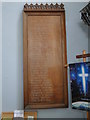
WW2 Memorial in New Catton Christchurch
The WW2 Memorial bears 31 names of men from New Catton who fell in WW2
Image: © Adrian S Pye
Taken: 8 Feb 2018
0.16 miles
10
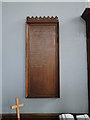
WW2 Memorial for the civilian casualties of bombing raids, New Catton
Of the sixteen names, twelve are female.
Image: © Adrian S Pye
Taken: 8 Feb 2018
0.16 miles