
IMAGES TAKEN NEAR TO
Bumblebee Gardens, BECCLES, NR34 9ZB
Introduction
This page details the photographs taken nearby to Bumblebee Gardens, NR34 9ZB by members of the Geograph project.
The Geograph project started in 2005 with the aim of publishing, organising and preserving representative images for every square kilometre of Great Britain, Ireland and the Isle of Man.

There are currently over 7.5m images from over14,400 individuals and you can help contribute to the project by visiting https://www.geograph.org.uk
Image Map
Images are licensed for reuse under creativecommons.org/licenses/by-sa/2.0
Notes
- Clicking on the map will re-center to the selected point.
- The higher the marker number, the further away the image location is from the centre of the postcode.
Image Listing (59 Images Found)
Images are licensed for reuse under creativecommons.org/licenses/by-sa/2.0
Image
Details
Distance
1
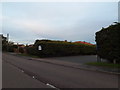
Entrance to Three Rivers Veterinary Group
Off the A145 London Road
http://threeriversvetgroup.co.uk/
Image: © Geographer
Taken: 7 Nov 2013
0.03 miles
2
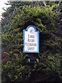
Three Rivers Veterinary Group sign
Off the A145 London Road
http://threeriversvetgroup.co.uk/
Image: © Geographer
Taken: 7 Nov 2013
0.05 miles
3
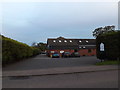
Three Rivers Veterinary Group
Off the A145 London Road
http://threeriversvetgroup.co.uk/
Image: © Geographer
Taken: 7 Nov 2013
0.05 miles
4
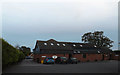
Three Rivers Veterinary Group
Off the A145 London Road
http://threeriversvetgroup.co.uk/
Image: © Geographer
Taken: 7 Nov 2013
0.05 miles
5
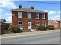
Former Victorian Gardens, London Road, Beccles
This is recorded in 1862, as Victorian Gardens, a public house for sale: "Red brick & slated Free Public House called Victorian Gardens adjoining the Turnpike Road leading from Beccles to Halesworth, with large yard, stables, convenient outbuildings & pump & large piece of garden ground & fruit trees & an enclosure of rich Pasture Land. Successive owners have changed the name to Beaumont House, The Lions, Dowe's Hill and Bethesda.
Image: © Adrian S Pye
Taken: 20 Aug 2023
0.06 miles
6
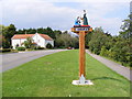
Beccles Town Sign
On the A145 London Road near the junction with Richard Crampton Road
Image: © Geographer
Taken: 8 Aug 2009
0.06 miles
7
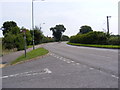
A145 London Road, Beccles
Looking towards Weston at the junction with Richard Crampton Road
Image: © Geographer
Taken: 8 Aug 2009
0.11 miles
8

Montrose Service Garage
Off the A145 London Road near the junction with Richard Crampton Road
Image: © Geographer
Taken: 8 Aug 2009
0.12 miles
9

Beccles Town Sign
On the A145 London Road near the junction with Richard Crampton Road
Image: © Geographer
Taken: 8 Aug 2009
0.12 miles
10
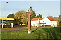
Beccles town sign (London Road)
Beccles has five identical town signs, one at each of the five entrances to the town. The first sign was erected at the outer end of Blyburgate soon after WWII. Signs have since been erected in Westwood Way, this one on London Road, Ellough Road and Northgate.
The sign depicts the presentation of the charter by Queen Elizabeth I to John Baas, the first Port Reeve of Beccles in 1584. The charter that was granted to the town by Queen Elizabeth 1, and dated July 2, 1584, proclaimed the lands around the town, (having previously belonged to the Church, but taken from it by Henry VIII) were formally granted for the benefit of the townspeople, and in 1605, following some attempts by the Rector to prove it invalid, was further confirmed by James I.
https://www.geograph.org.uk/photo/4211026
Image: © Adrian S Pye
Taken: 19 Nov 2020
0.12 miles