
IMAGES TAKEN NEAR TO
All Saints Drive, BECCLES, NR34 9UP
Introduction
This page details the photographs taken nearby to All Saints Drive, NR34 9UP by members of the Geograph project.
The Geograph project started in 2005 with the aim of publishing, organising and preserving representative images for every square kilometre of Great Britain, Ireland and the Isle of Man.

There are currently over 7.5m images from over14,400 individuals and you can help contribute to the project by visiting https://www.geograph.org.uk
Image Map
Images are licensed for reuse under creativecommons.org/licenses/by-sa/2.0
Notes
- Clicking on the map will re-center to the selected point.
- The higher the marker number, the further away the image location is from the centre of the postcode.
Image Listing (51 Images Found)
Images are licensed for reuse under creativecommons.org/licenses/by-sa/2.0
Image
Details
Distance
1
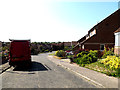
St.Benet's Drive, Beccles
Near the junction with St.Andrew's Road
Image: © Geographer
Taken: 15 May 2014
0.06 miles
2
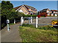
Path to St.Andrew's Road
Off St.Benet's Drive
Image: © Geographer
Taken: 15 May 2014
0.07 miles
4
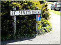
St.Benet's Drive sign
On St.Benet's Drive at the junction with Nicholson Drive
Image: © Geographer
Taken: 15 May 2014
0.10 miles
5
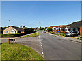
Nicholson Drive, Beccles
At the junction with Townlands Drive
Image: © Geographer
Taken: 15 May 2014
0.11 miles
6
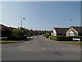
Townlands Drive, Beccles
At the junction with Nicholson Drive
Image: © Geographer
Taken: 15 May 2014
0.11 miles
7
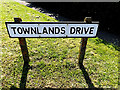
Townlands Drive sign
On Townlands Drive at the junction with Nicholson Drive
Image: © Geographer
Taken: 15 May 2014
0.11 miles
8
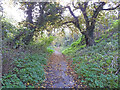
Rigbourne Hill Lane, Beccles
Rigbourne Hill Lane was established hundreds of years before Rigbourne Hill was developed just after WWII. Although it now has a tarmac pathway it is not as well used as it might be. From the start at Swines Green the lane is approximately 700 yards in length with a ascent of about 70 feet emerging at the top of Banham Road. From there it continues along Oak Lane, a name which was given to the road when developed, continuing to with a change of name to Dirty Lane, after crossing Beccles southern bypass it reemerges as Cucumber Lane, terminating at a former ford, (now bridged) in Church Road, Weston; a total distance of one and a half miles.
The name Rigbourne comes from the time of the Danelaw, rygg-bone meaning backbone.
Image: © Adrian S Pye
Taken: 20 Nov 2023
0.12 miles
9
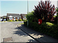
Townlands Drive Postbox
On Townlands Drive at the junction with Nicholson Drive
Postbox No.NR34 3481
Image: © Geographer
Taken: 15 May 2014
0.12 miles
10
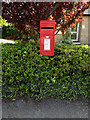
Townlands Drive Postbox
On Townlands Drive at the junction with Nicholson Drive
Postbox No.NR34 3481
(Close up)
Image: © Geographer
Taken: 15 May 2014
0.12 miles