
IMAGES TAKEN NEAR TO
Common Lane North, BECCLES, NR34 9BN
Introduction
This page details the photographs taken nearby to Common Lane North, NR34 9BN by members of the Geograph project.
The Geograph project started in 2005 with the aim of publishing, organising and preserving representative images for every square kilometre of Great Britain, Ireland and the Isle of Man.

There are currently over 7.5m images from over14,400 individuals and you can help contribute to the project by visiting https://www.geograph.org.uk
Image Map
Images are licensed for reuse under creativecommons.org/licenses/by-sa/2.0
Notes
- Clicking on the map will re-center to the selected point.
- The higher the marker number, the further away the image location is from the centre of the postcode.
Image Listing (395 Images Found)
Images are licensed for reuse under creativecommons.org/licenses/by-sa/2.0
Image
Details
Distance
1

Common Lane North Industrial Estate
The car park was built on the site of the old railway line which would have passed the camera and continued past where the tallest tree now stands before reaching the crossing on Pound Road.
Image: © Adrian S Pye
Taken: 21 Nov 2022
0.01 miles
2
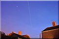
Science in the Sky
Taken over 111 seconds this is a view of the International Space Station, it glides over our heads almost every night, two to three times. This was the 23.10pm fly over taking about 4 minutes to pass over. Having taken this picture 23:10-23:13pm at the time of writing (23.30pm) it is already over India, speed is 17227 mph.
It is very bright, its massive solar panels reflecting off the sun (average magnitude is -2). Not only is it the most expensive thing ever built (100 billion euros) it is the home of several astronauts for 6 months at a time.
http://en.wikipedia.org/wiki/International_Space_Station
Image: © Ashley Dace
Taken: 30 Jun 2010
0.03 miles
3

Car park on the former railway line
The railway passed right to left immediately between the camera and the side of the building ahead on its way to Tivetshall via Geldeston Station, the next stop.
Image: © Adrian S Pye
Taken: 21 Nov 2022
0.03 miles
4

Beccles Industrial Area
Offices to the left (NHS Waveney) and car garages to the right.
Image: © Ashley Dace
Taken: 4 May 2010
0.05 miles
5
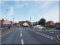
Common Lane North, Beccles
At the entrance to Lidl Superstore
Image: © Geographer
Taken: 16 Jun 2020
0.05 miles
6

Common Lane North sign
On Common Lane North at the junction with the A145 George Westwood Way
Image: © Geographer
Taken: 9 Jun 2020
0.06 miles
7

Common Lane North sign
On Common Lane North at the junction with the A145 George Westwood Way
Image: © Geographer
Taken: 9 Jun 2020
0.06 miles
8

Common Lane North, Beccles
At the junction with the A145 George Westwood Way
Image: © Geographer
Taken: 9 Jun 2020
0.06 miles

10

Beccles animal pound or pinfold
The pound was where stray livestock were impounded. Animals were kept in a dedicated enclosure, until claimed by their owners, or sold to cover the costs of impounding.
If unclaimed within three weeks, the animals were driven to the nearest market and sold, the proceeds going to the impounder and pound-keeper.
"The person who found the animals on his land cut a stick and made notches, one for every beast, and then split the stick down the centre of the notches so that half each notch appeared on each stick; one half he kept, the other he gave to the pound-keeper.
When the owner came to redeem his property and had paid for the damage done, the impounder gave him his half stick. He took this to the pound-keeper, and if the two pieces tallied, it proved he had paid and his beast was freed. Hence the word tally-stick and the pound-keeper being referred to as the tallyman." (Gratefully borrowed from Wikipedia.)
Image: © Adrian S Pye
Taken: 11 Sep 2023
0.07 miles