
IMAGES TAKEN NEAR TO
Halesworth Road, BECCLES, NR34 8NF
Introduction
This page details the photographs taken nearby to Halesworth Road, NR34 8NF by members of the Geograph project.
The Geograph project started in 2005 with the aim of publishing, organising and preserving representative images for every square kilometre of Great Britain, Ireland and the Isle of Man.

There are currently over 7.5m images from over14,400 individuals and you can help contribute to the project by visiting https://www.geograph.org.uk
Image Map
Images are licensed for reuse under creativecommons.org/licenses/by-sa/2.0
Notes
- Clicking on the map will re-center to the selected point.
- The higher the marker number, the further away the image location is from the centre of the postcode.
Image Listing (13 Images Found)
Images are licensed for reuse under creativecommons.org/licenses/by-sa/2.0
Image
Details
Distance
2
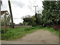
Footpath between houses
From here the footpath crosses fields and terminates near Brampton Station.
Image: © Adrian S Pye
Taken: 3 Sep 2010
0.04 miles
4
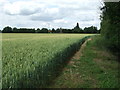
Footpath And Field Boundary
Footpath and field boundary near to Redisham, Suffolk.
Image: © Keith Evans
Taken: 9 Jul 2015
0.05 miles
5

The former 'Wig' public house in Redisham
Now much enlarged and a private house conveniently named 'Wig House'.
Image: © Adrian S Pye
Taken: 15 Feb 2017
0.06 miles
6
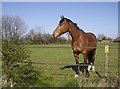
Pride of Redisham
In a paddock near Poplar Tree Farm.
Image: © Graham Horn
Taken: 7 Apr 2007
0.06 miles
8
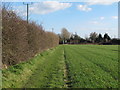
Footpath through arable land to Halesworth Road, Redisham
Image: © Roger Jones
Taken: 25 Mar 2016
0.09 miles
9

Red House Farm
Although it is painted white, this is Red House Farm, Redisham, Suffolk.
Image: © Adrian S Pye
Taken: 19 Aug 2010
0.19 miles
10
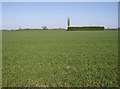
What's in the green square?
There is a building in here, completely hidden from the south west by this hedge, and the 1:25K map shows the hedge all the way round in a square. The fields around are all large and arable.
Image: © Graham Horn
Taken: 7 Apr 2007
0.21 miles