
IMAGES TAKEN NEAR TO
Benacre Road, BECCLES, NR34 7XD
Introduction
This page details the photographs taken nearby to Benacre Road, NR34 7XD by members of the Geograph project.
The Geograph project started in 2005 with the aim of publishing, organising and preserving representative images for every square kilometre of Great Britain, Ireland and the Isle of Man.

There are currently over 7.5m images from over14,400 individuals and you can help contribute to the project by visiting https://www.geograph.org.uk
Image Map
Images are licensed for reuse under creativecommons.org/licenses/by-sa/2.0
Notes
- Clicking on the map will re-center to the selected point.
- The higher the marker number, the further away the image location is from the centre of the postcode.
Image Listing (16 Images Found)
Images are licensed for reuse under creativecommons.org/licenses/by-sa/2.0
Image
Details
Distance
1

Driving school training area, Ellough
The flags seen in the background stand beside the entrance to the Kart track.
Image: © Evelyn Simak
Taken: 22 May 2013
0.06 miles

3

Old tyres beside bridleway to Benacre Road, Ellough
Image: © Evelyn Simak
Taken: 22 May 2013
0.11 miles

5
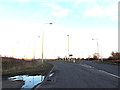
Benacre Road, Ellough
At the junction with the B1127 Benacre Road & B1127 Copland Way
Image: © Geographer
Taken: 13 Feb 2014
0.13 miles
6

B1127 roundabout by Ellough industrial estate
Image: © Evelyn Simak
Taken: 22 May 2013
0.14 miles
7
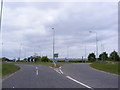
B1127 Bencacre Road, Ellough
At the roundabout junction with the B1127 Copland Way
Image: © Geographer
Taken: 10 Jun 2013
0.15 miles
8
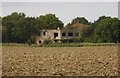
Control Tower / Watch Office, RAF Beccles
RAF Beccles was built by the USAAF in 1943 but passed briefly to RAF Bomber Command before passing to Coastal Command in August 1944. Until closure in 1945 the airfield was used by various RAF and FAA squadrons operating such diverse types as Warwick, Barracuda, Walrus, Swordfish, Sea Otter and Albacore on air-sea rescue and anti-shipping duties. At one time Beccles was called HMS Hornbill II. This photo is of the Battle Headquarters which can also be seen from the road from Ellough to Beccles which runs behind the trees. Now a derelict shell the RAF roundels can still be seen painted on the outside.
Image: © Helen Steed
Taken: 9 Sep 2007
0.15 miles
9

Overgrown blast shelter
This brick-built blast shelter is the only structure still surviving near the spot where the Watch office of RAF Beccles used to stand > http://www.geograph.org.uk/photo/4121626. The Watch office > http://www.geograph.org.uk/photo/554203 and the nearby Battle headquarters, of which unfortunately no photograph would seem to exist, both were demolished in 2009.
Image: © Evelyn Simak
Taken: 16 Aug 2014
0.16 miles
10

A heap of rubble
This is the spot where the Watch office used to stand until it was demolished in 2009. Luckily, Helen Steed photographed the derelict structure before its demise > http://www.geograph.org.uk/photo/554203. The rubble has been deposited here recently, it does not originate from the Watch office.
Image: © Evelyn Simak
Taken: 16 Aug 2014
0.17 miles