
IMAGES TAKEN NEAR TO
Southwold Road, BECCLES, NR34 7JF
Introduction
This page details the photographs taken nearby to Southwold Road, NR34 7JF by members of the Geograph project.
The Geograph project started in 2005 with the aim of publishing, organising and preserving representative images for every square kilometre of Great Britain, Ireland and the Isle of Man.

There are currently over 7.5m images from over14,400 individuals and you can help contribute to the project by visiting https://www.geograph.org.uk
Image Map
Images are licensed for reuse under creativecommons.org/licenses/by-sa/2.0
Notes
- Clicking on the map will re-center to the selected point.
- The higher the marker number, the further away the image location is from the centre of the postcode.
Image Listing (28 Images Found)
Images are licensed for reuse under creativecommons.org/licenses/by-sa/2.0
Image
Details
Distance
1

Wrentham street
Driving through Wrentham from Southwold. 30mph speed limit through this little village
Image: © Ashley Dace
Taken: 24 Nov 2009
0.06 miles
2

Wrentham Chapel
Off the A12 London Road taken from the junction with Mill Lane
Image: © Geographer
Taken: 19 Jun 2009
0.17 miles
3

Wrentham Village Hall
Off the A12 London Road
Image: © Geographer
Taken: 19 Jun 2009
0.18 miles
4

Horse and Groom public house, Wrentham, from the carpark
https://www.geograph.org.uk/photo/6202929
Image: © Adrian S Pye
Taken: 6 Jul 2019
0.18 miles
5

Sign of The Horse and Groom public house, Wrentham
https://www.geograph.org.uk/photo/6202926
Image: © Adrian S Pye
Taken: 6 Jul 2019
0.18 miles
6

The Horse and Groom, Wrentham
This old public house is on the south side of the crossroads at Wrentham on the A12.
Image: © Adrian S Pye
Taken: 23 Sep 2010
0.18 miles
7

Wrentham Village Notice Board
On the A12 London Road
Image: © Geographer
Taken: 19 Jun 2009
0.19 miles
8

Wrentham Carpark
Along with bus shelter and telephone box
Image: © Ashley Dace
Taken: 24 Nov 2009
0.19 miles
9

Old Cast Iron Milepost
Old cast iron milepost Wrentham, Suffolk. For close up view see http://www.geograph.org.uk/photo/1175733 for more info on the post see http://milestones.megalithia.com/sites/tm496826.htm do look at their home page.
Image: © Keith Evans
Taken: 23 Feb 2009
0.19 miles
10
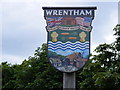
Wrentham Village Sign
On the A12 London Road at the junction with Mill Lane
(Close up)
Image: © Geographer
Taken: 19 Jun 2009
0.19 miles