
IMAGES TAKEN NEAR TO
Dixon Drive, LOWESTOFT, NR33 9PF
Introduction
This page details the photographs taken nearby to Dixon Drive, NR33 9PF by members of the Geograph project.
The Geograph project started in 2005 with the aim of publishing, organising and preserving representative images for every square kilometre of Great Britain, Ireland and the Isle of Man.

There are currently over 7.5m images from over14,400 individuals and you can help contribute to the project by visiting https://www.geograph.org.uk
Image Map
Images are licensed for reuse under creativecommons.org/licenses/by-sa/2.0
Notes
- Clicking on the map will re-center to the selected point.
- The higher the marker number, the further away the image location is from the centre of the postcode.
Image Listing (50 Images Found)
Images are licensed for reuse under creativecommons.org/licenses/by-sa/2.0
Image
Details
Distance
1

Caterpillar of the Grey Dagger moth
This one is feeding on cherry tree leaves. http://ukmoths.org.uk/show.php?bf=2284 Thanks to kayjay for helping with the identification.
Image: © Adrian S Pye
Taken: 14 Sep 2010
0.03 miles
2
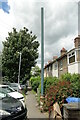
Stench pipe in Sycamore Avenue, Lowestoft
The pipe is of a type common in Lowestoft, made by Ham Baker & Co - Limited - Engineers - Westminster. Like this one Image
Image: © Adrian S Pye
Taken: 2 Jul 2022
0.07 miles

4

Oulton Broad South railway station
#2
The A1117 Beccles Road crosses the line and becomes Bridge Road.
Where the track bends was the branch line which continued straight on into what is now The Beeches Mobile Home Park.
Image
Image: © Adrian S Pye
Taken: 27 Jul 2022
0.12 miles
5

Oulton Broad South railway station - branch line
#3
Where the track bends was the branch line turnout, which continued straight on into what is now The Beeches Mobile Home Park.
Image
Image: © Adrian S Pye
Taken: 27 Jul 2022
0.12 miles
6

The Beeches Mobile Home Park
#5
The old track-bed from the car park.
Image
Access to the Park was kindly granted by the site manager.
Image: © Adrian S Pye
Taken: 27 Jul 2022
0.12 miles
7

Oulton Broad St Mark?s church
The church of St Mark was designed and built by local architects Roberts, Green and Richards in 1884. This area was once part of Carlton Colville but has become a separate parish in its own right and a need for its own church was obvious. For me the most outstanding feature is the east window; put in around 1960, made by Abbot & Co. It depicts the Blessed Virgin and Child and is ablaze with of colour. http://www.geograph.org.uk/photo/2106943 The organ chamber is built onto the side of the south aisle. In 1990, because of the popularity of this particular church, parish rooms were added to the north of the building. The font and pulpit are Victorian, the seating is a little more up to date but traditional benches, rather than individual chairs, which may be core comfortable, but somehow don’t look right in a church.
Image: © Adrian S Pye
Taken: 11 Oct 2010
0.13 miles
8
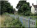
Oulton Broad road bridge
#4
As seen from roughly where the old track-bed ran. Taken from the car park at The Beeches Mobile Home Park.
Image
Image: © Adrian S Pye
Taken: 27 Jul 2022
0.13 miles
10

Oulton Broad St Mark's church
The east window.
Image: © Adrian S Pye
Taken: 11 Oct 2010
0.14 miles