IMAGES TAKEN NEAR TO
School Road, LOWESTOFT, NR33 9NA
Introduction
This page details the photographs taken nearby to School Road, NR33 9NA by members of the Geograph project.
The Geograph project started in 2005 with the aim of publishing, organising and preserving representative images for every square kilometre of Great Britain, Ireland and the Isle of Man.

There are currently over 7.5m images from over14,400 individuals and you can help contribute to the project by visiting https://www.geograph.org.uk
Image Map
Images are licensed for reuse under creativecommons.org/licenses/by-sa/2.0
Notes
- Clicking on the map will re-center to the selected point.
- The higher the marker number, the further away the image location is from the centre of the postcode.
Image Listing (68 Images Found)
Images are licensed for reuse under creativecommons.org/licenses/by-sa/2.0
Image
Details
Distance
1

View across Lake Lothing towards the shipyards
Image: © Adrian S Pye
Taken: 3 Jun 2014
0.11 miles
2
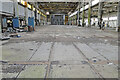
Railway line passing through a former fabrication workshop
Part of the former Brooke Marine shipbuilding yard.
Image
Image: © Adrian S Pye
Taken: 27 Jul 2022
0.13 miles
3

1st Oulton Broad Sea Scout Group headquarters
Image: © Helen Steed
Taken: 15 May 2021
0.15 miles
4

GR post box
This post box is on the side of a Londis shop in Victoria Road, Lowestoft. To see the shop > http://www.geograph.org.uk/photo/2075010.
Image: © Adrian S Pye
Taken: 20 Sep 2010
0.15 miles
5

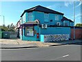
Londis with a GR post box
The shop is in Victoria Road, Lowestoft and has a GR post box on the side. To view the box > http://www.geograph.org.uk/photo/2075004
Image: © Adrian S Pye
Taken: 20 Sep 2010
0.15 miles
6

Gull on chimney pot, Brooke Marine
For a wider view of this location see > http://www.geograph.org.uk/photo/3479798.
Image: © Evelyn Simak
Taken: 27 May 2013
0.15 miles
8

Dilapidated ship (detail) on Lake Lothing
A wider view of this location can be seen here > http://www.geograph.org.uk/photo/3479705.
Image: © Evelyn Simak
Taken: 27 May 2013
0.15 miles
9
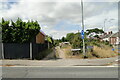
The site of the Colville Road crossing
#11
Looking west to the course of the old line across the road where the crossing used to be. From the old map it doesn't seem to have been a road as it is today. The old track-bed is now utilised for access to garages and rear entrances as well as being a footpath and cycle-path away from the traffic on Victoria Road.
Image
Image: © Adrian S Pye
Taken: 27 Jul 2022
0.16 miles