
IMAGES TAKEN NEAR TO
Hawthorn Avenue, LOWESTOFT, NR33 9BA
Introduction
This page details the photographs taken nearby to Hawthorn Avenue, NR33 9BA by members of the Geograph project.
The Geograph project started in 2005 with the aim of publishing, organising and preserving representative images for every square kilometre of Great Britain, Ireland and the Isle of Man.

There are currently over 7.5m images from over14,400 individuals and you can help contribute to the project by visiting https://www.geograph.org.uk
Image Map
Images are licensed for reuse under creativecommons.org/licenses/by-sa/2.0
Notes
- Clicking on the map will re-center to the selected point.
- The higher the marker number, the further away the image location is from the centre of the postcode.
Image Listing (19 Images Found)
Images are licensed for reuse under creativecommons.org/licenses/by-sa/2.0
Image
Details
Distance
1
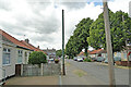
Stench pipe in Dell Road East, Lowestoft
One of a similar pair 150 yards distant from each other Image The manufacturer's plate reads "Ham Baker & Co Ltd - Makers - Westminster".
The plate is identical to its neighbour Image
Image: © Adrian S Pye
Taken: 2 Jul 2022
0.20 miles
2
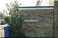
Delius Close street sign, Lowestoft
Named in honour of Frederick Theodore Albert Delius (1862 – 1934), originally Fritz Delius, was an English composer. He was born in Bradford in Yorkshire. His father Julius, moved from Westphalia to England to further his career as a wool merchant, and became a naturalised British subject in 1850.
Image: © Adrian S Pye
Taken: 8 Aug 2022
0.21 miles
3
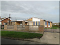
Oulton Broad St Luke the Evangelist's church
The church was built in 1959 on land donated by Mr and Mrs W. H. Winter. The church is just one of the amenities on the surrounding housing estate.
Image: © Adrian S Pye
Taken: 3 Nov 2010
0.22 miles
4
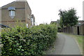
Nile court was built just to the left of the track
#15
The track would have passed between the building and the footpath and continued straight on to the crossing at the top of Kirkley Run, passing close to Horatio Court and Collingwood Court on the way
Image: © Adrian S Pye
Taken: 28 Jul 2022
0.22 miles
5
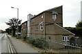
Horatio Court, Lowestoft
Horatio Court, is accessed from Dell Road East and was named in Honour of Admiral Lord Nelson and his association with the town. Admirals Nelson and Collingwood first met when both served on the frigate HMS Lowestoffe in 1777. The neighbouring block is named in honour of Admiral Collingwood. Image]
Image: © Adrian S Pye
Taken: 28 Jul 2022
0.22 miles
6
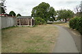
Track of the old branch line
#14
Looking west, with Victoria Road just visible on the right, the track would have been on the grassed area to the right of the fence and passing directly beneath the camera.
Image
Image: © Adrian S Pye
Taken: 28 Jul 2022
0.22 miles
7
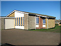
St Luke the Evangelist's church
The church was built in 1959 in the same style as the adjoining bungalows. See also > http://www.geograph.org.uk/photo/2142879.
Image: © Evelyn Simak
Taken: 16 Feb 2014
0.22 miles
8
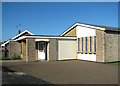
Entrance porch to St Luke the Evangelist's church
The church was built in 1959 in the same style as the adjoining bungalows. See also http://www.geograph.org.uk/photo/2142879.
Image: © Evelyn Simak
Taken: 16 Feb 2014
0.22 miles
9
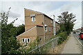
Nile Court, Dell Road East
Viewed from Victoria Road it was named after Nelson's Victory at the Battle of the Nile.
Two other neighbouring blocks are names Horatio Court and Collingwood Court. Image] Image]
Image: © Adrian S Pye
Taken: 28 Jul 2022
0.22 miles
10
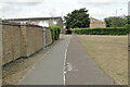
Track of old railway line before Kirkley Run level crossing
The line at this point has travelled between Victoria Road and Dell Road since leaving Oulton Broad South station. Here it crosses Kirkley Run over a level crossing passing the gatekeepers cottage on the left.
Image and proceeds eastward between Kimberley Road and Notley Road. Image
Image: © Adrian S Pye
Taken: 26 Jul 2022
0.22 miles